


News - GLOBE Observer


Science is Better Together: The Real-World Benefit of the NASA GLOBE Observer Trees Tool
2021 Trees Community Challenge: Science is Better Together logo. Credit: NASA GLOBE Observer
The 2021 GLOBE Community Trees Challenge is going on now. Visit the challenge page to learn how you can learn and contribute knowledge about trees. Plus, access some really cool resources and activities all about trees. (More details about the challenge are also at the end of this blog entry.)
The NASA GO trees tool and NASA observations from space:
The NASA GLOBE Observer (NASA GO) Trees Tool is an app-based tool that helps you estimate tree height by simply using your mobile device. If you happen to have a tape measure, you can also measure the circumference of the tree and input that data into the tool. Tracking how trees are changing over time can help us estimate the number of trees that make up an area. Measuring tree height from the ground is a vital way to build a robust and accurate dataset.
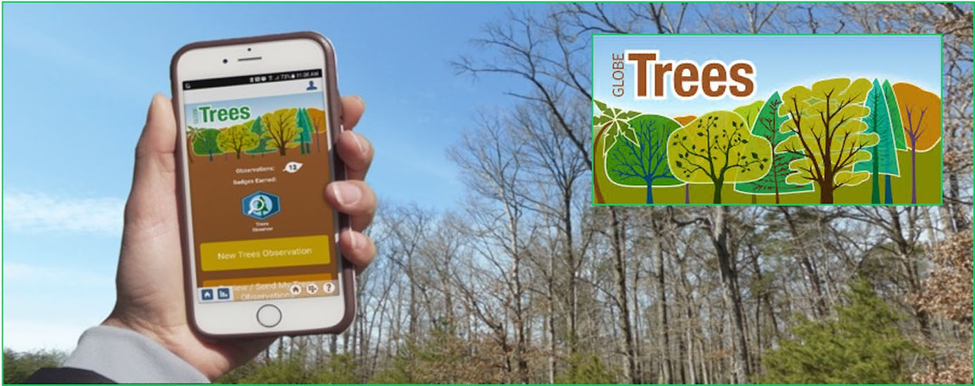
The NASA GLOBE Observer App’s Trees Tool. Credit: NASA GLOBE Observer
About tree height:
Tree height is the most widely used indicator of an ecosystem's ability to grow trees, so tracking tree height over time can help us to assess the ecological health of a given area. Tree circumference can be used by foresters and managers to calculate the approximate age of the tree, and the measurements are also used to estimate the amount of standing timber in a forest. Both tree height and trunk circumference can also help to measure biomass, the total mass of living material above ground measured across a particular area.
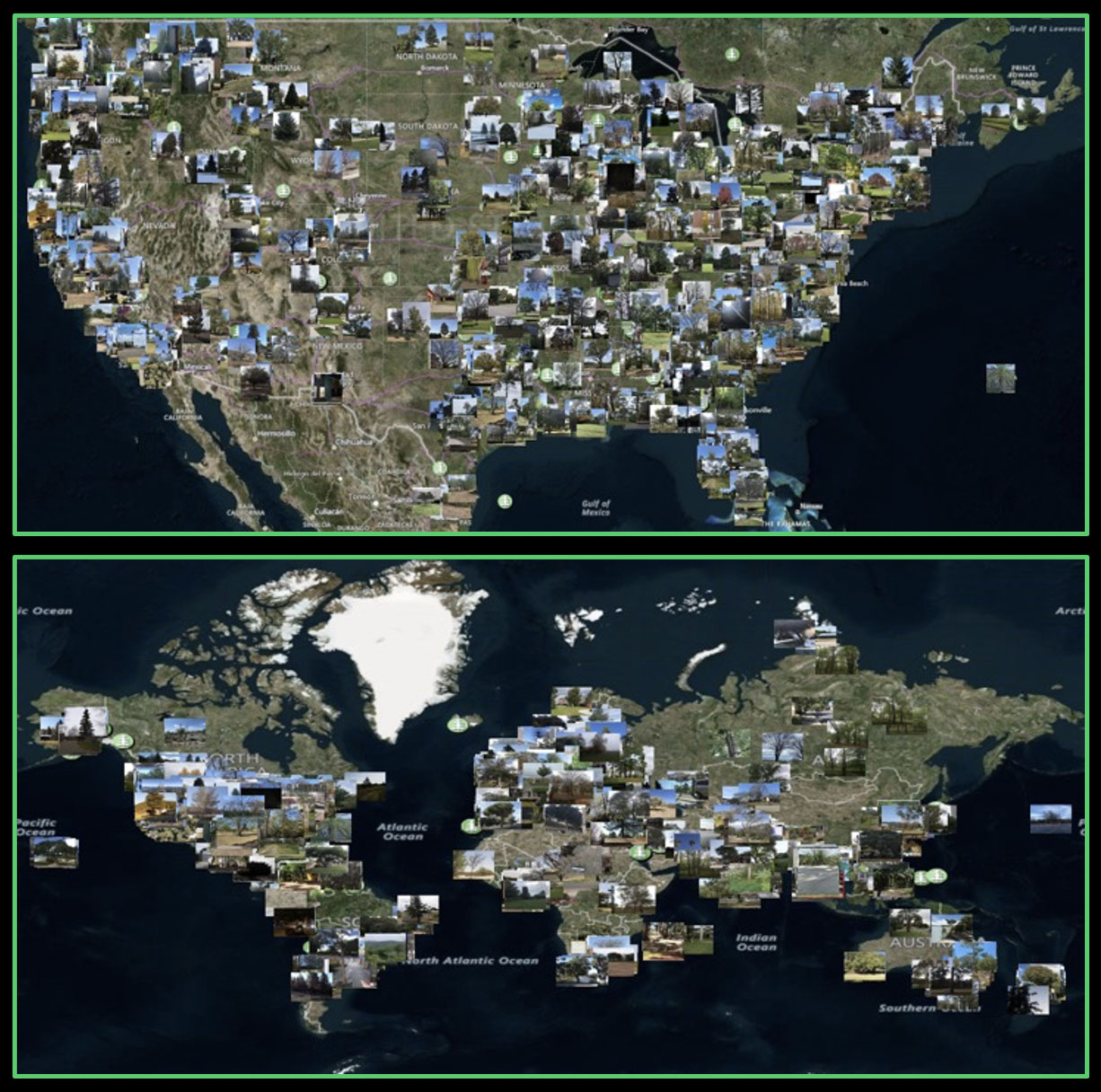
The GLOBE Program Visualization System’s ground-based tree height observations submitted to the GLOBE database. Credit: Brian Campbell
NASA and trees:
NASA uses field campaigns and sensors on satellites and the International Space Station (ISS) to improve our understanding of how much carbon is being stored in terrestrial ecosystems and how this could change as patterns of drought, fire, and forest ecosystems shift in a changing climate.
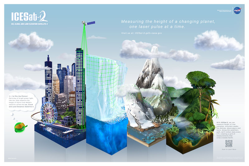
ICESat-2 measures the height of Earth’s objects, like ice, mountains, water, buildings, and trees. Credit: ICESat-2 Mission
The benefits of comparing NASA GO and ICESat-2 tree height data:
Ground sources of data, like that from the NASA GO trees tool are needed to compare to the measurements from satellites, and observations from citizen scientists can help fill in gaps in that data. For example, ground-based citizen science tree height measurements will help scientists working on NASA missions like ICESat-2, which is measuring the heights of forest canopies worldwide. Citizen scientists are also able to gather tree heights from many more places than the ICESat-2 scientists alone could measure.
Scientists from the NASA Ice, Cloud, and land Elevation Satellite-2 or ICESat-2, plan to look for places where clusters of citizen scientist measurements overlap with ICESat-2’s measurements and compare the two datasets. An example of this type of comparison can be seen in the graphics below:
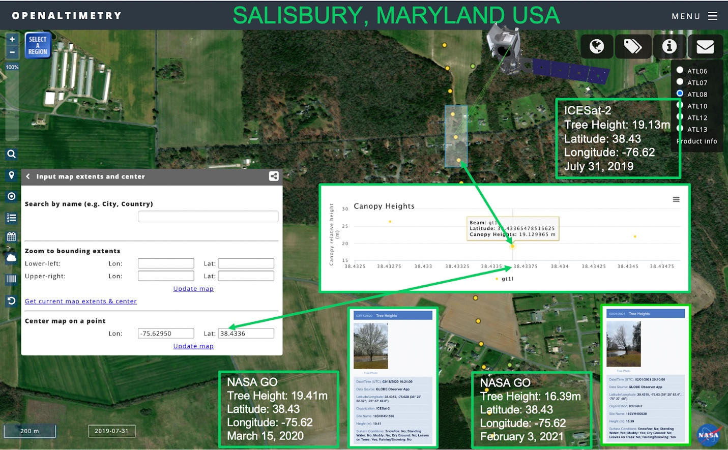
Comparing tree height data for a Maryland Bradford Pear Tree using the NASA GLOBE Observer Trees Tool and ICESat-2 tree height data using the Open Altimetry online tool. Credit: Brian Campbell
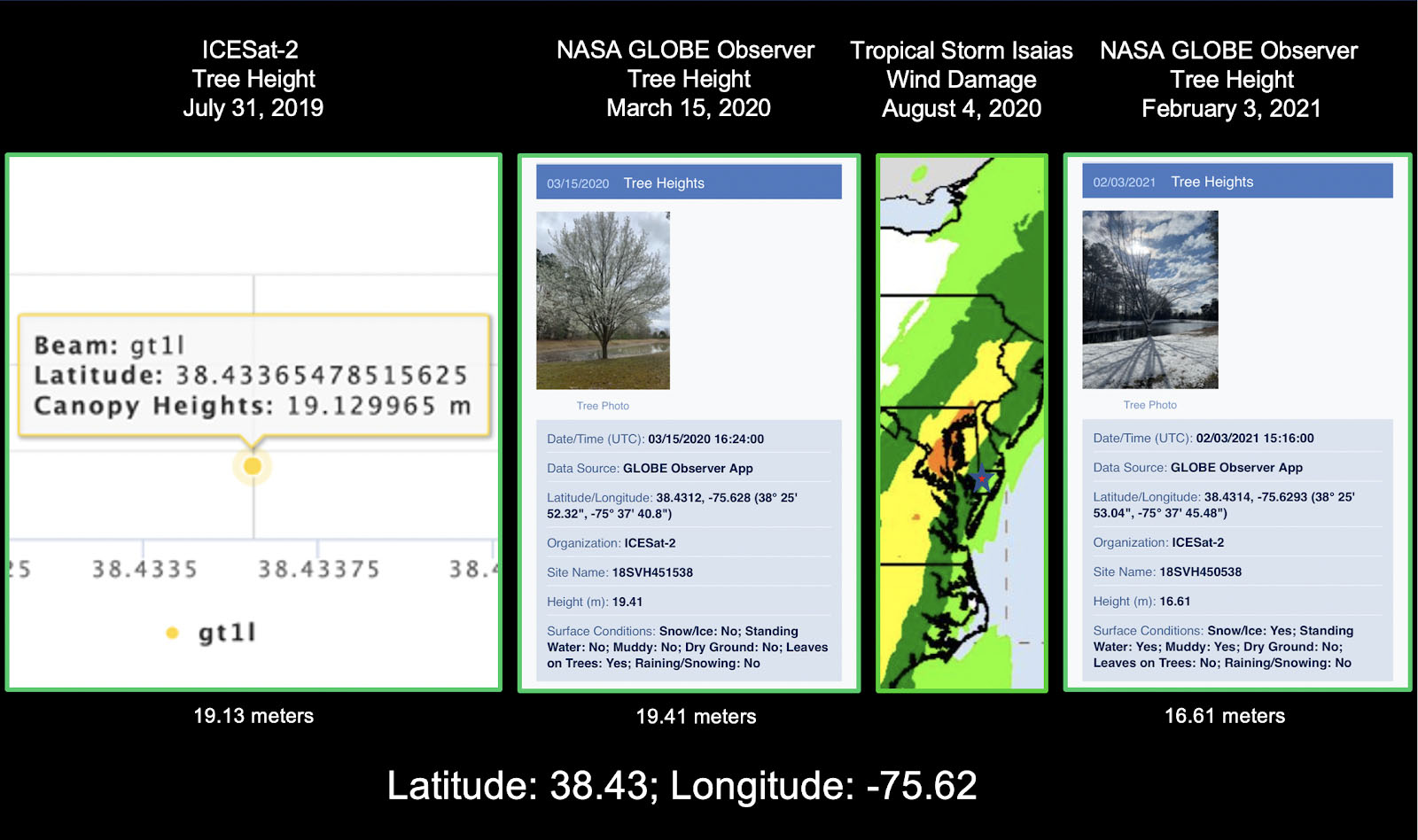
Looking at the change in tree height from a significant weather event, Tropical Storm Isaias, in August 2020. Left is the tree height data from ICESat-2 on 31-July-2019, left center is a NASA GO tree height of Bradford Pear tree from 15-March-2020, right center is a precipitation map from Tropical Storm Isaias, and right is a NASA GO tree height measurement of same Bradford Pear tree from 3-February-2021. Credit: Brian Campbell

Since trees are land cover, it is the best decision to also take a NASA GO Land Cover observation while you are standing at the base of the tree. The data from this will provide a much more comprehensive picture of the environment in which the tree is located. Credit: Brian Campbell
The 2021 Trees Community Challenge: Science is Better Together:
Now that you see just how vital citizen science observations of trees are, how about joining in and celebrating science and fun with the 2021 Trees Community Challenge: Science is Better Together?
During the Community Trees Challenge, GLOBE and GLOBE Observer are asking citizen scientists to observe, learn, engage, and create as they track their progress on the Community Trees Challenge Activity Tracker.
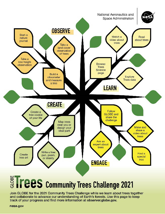
2021 Community Trees Challenge Activity Tracker. Credit: NASA GLOBE Observer
You can choose as many or as few of the activities as you like to participate. Work together as a family, as a group of friends, or independently – it is up to you.
Check out the 2021 Trees Community Challenge: Science is Better Together at: https://observer.globe.gov/trees-2021
Brian Campbell (NASA Wallops/GST) is a NASA Senior Earth Science Outreach Specialist at the NASA Goddard Space Flight Center’s Wallops Flight Facility in Wallops Island, Virginia USA. Brian is also the Trees Around the GLOBE Student Research Campaign Lead and the Trees Science Lead for the NASA GLOBE Observer citizen science program. Brian works with local to international students in over fifty countries.
Comments
View more GLOBE Observer news here.