by Emily Fischer
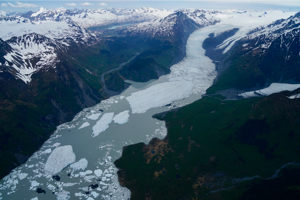
Flying a plane over Alaska’s vast landscape provides a birds-eye view of some incredible sights. Bears run across frigid streams, moose trample through mounds of snow, and golden eagles own the air above ice-capped mountains. Glaciers cut paths through these mountains, leaving lakes and rivers in their wake. These glaciers are especially interesting to scientists who want to learn more about climate change in a region that is changing more than any other.

According to Christopher Larsen, project manager of Operation IceBridge (OIB) Alaska, these glaciers are losing on the order of 75 billion tons of ice each year, which contribute to global sea level rise. Learning more about these mysterious, ancient ice formations could give scientists a better understanding about the impacts of global climate change in the Arctic.
Thousands of miles above the surface of these glaciers, satellites collect data on how these gargantuan slabs of ice are changing. Ice, Cloud and land Elevation Satellite-2 (ICESat-2) was launched in 2018, 11 years after its predecessor was decommissioned. In the decade in between, OIB bridged the gap, collecting data and exploring Alaskan glaciers with a whole new perspective.
Now, two years after ICESat-2 made its way into low-Earth orbit, OIB is finishing its final campaign. Having wrapped up its flight season last week, the team plans to do a final set of flights in August. And Larsen, a research professor at the University of Alaska Fairbanks, will finish up his last of eleven summers managing OIB Alaska.
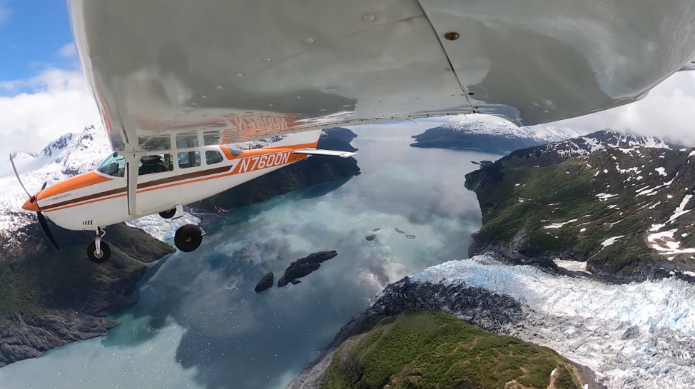
Instead of satellites, his team collects data using instruments aboard two small, single-engine aircraft. They shoot a laser from the bottom of each plane that hits the glacier’s surface and bounces back up. By calculating the amount of time it takes the laser pulses to return to the instruments, Larsen and his team can then estimate the surface elevation of the glacier at specific coordinates.
He said that most science projects at the university only last three years, but IceBridge Alaska has studied glaciers for over a decade.
“I’ve been involved in almost all of the flight campaigns myself,” Larsen said. “It’s really wonderful to have something that’s dedicated to monitoring and observing glaciers over a longer time period.”
Alaskan glaciers are temperate, meaning the ice is at or near melting point, and they melt and refreeze as they adjust to changes in the climate to maintain a balance between ice accumulation and melting. As the Arctic is warming at twice the global average, ice loss is accelerating, contributing to global sea level rise.
One problem with studying temperate glaciers is measuring depth. Radar doesn’t permeate water well, so determining ice thickness can be a challenge. To resolve this problem, the team must use a different frequency range, which isn’t always 100% effective. Despite this challenge, Larsen and his team have determined that some of the thickest ice in Alaska is on the order of 4,900 feet (1500 meters) and located in the Bagley Ice Valley. If all of that ice were to melt, the whole valley could turn into a lake or fjord.
But predictions of ice melt are hard to make because of the individual nature of glaciers. Like snowflakes, all are unique and respond differently to changes in the environment. “What we’ve found in general is that there’s a lot of variation from glacier to glacier, and it’s hard to pin that to any [common] characteristic of a glacier,” Larsen summarized.
And these glaciers have lost a lot of ice.
Not only are scientific barriers a challenge – physical limitations affect the flight campaign as well. For instance, the weather plays a huge role in the operation’s success. Larsen and his team check the weather constantly and plan their flights a day or two in advance based on wind and storm patterns. Weather is the true determinant of where and when they can fly. While satellites collect data at set intervals, planes that rely on clear and calm skies don’t always have this luxury.
The greatest challenge, according to Larsen, is collecting measurements of the same glaciers at consistent intervals. “And that’s driven mainly because you’re operating a light aircraft in large mountains with big weather systems,” he explained.
Nevertheless, the IceBridge Alaska campaign has been able to successfully collect data by running a relatively small campaign with a flexible team. Their pilots sometimes have to change survey paths mid-flight due to the weather, and research teams work proactively to prioritize safety and efficiency. Adding a new plane this summer has boosted productivity exponentially.
Besides their successful data collection on Alaskan glaciers, the IceBridge team has combined scientific processes with personal observations, some of which have been peculiar, to say the least.
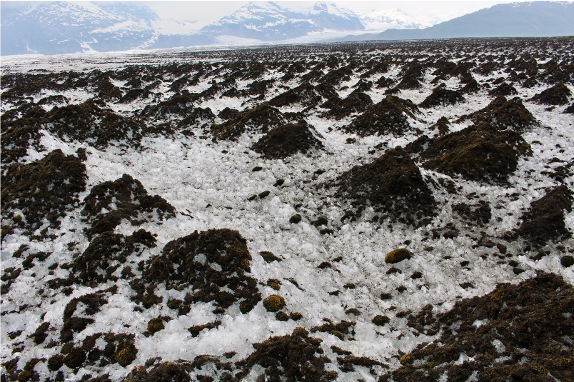
Case in point: While flying over Yakutat Glacier, on the Gulf of Alaska’s coast, Larsen was surprised to see that the glacier was almost entirely concealed by a dark mass. When the plane flew closer, he realized that the ice was actually covered by many fuzzy moss balls, fondly nicknamed “glacier mice” by researchers. These tumbleweeds of Alaskan glaciers are still a mystery to scientists who track their movements. Larsen has seen Yakutat Glacier break apart into large icebergs and retreat significantly over the past few years. Most of the moss balls have ended up in Harlequin Lake.