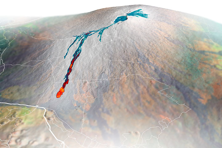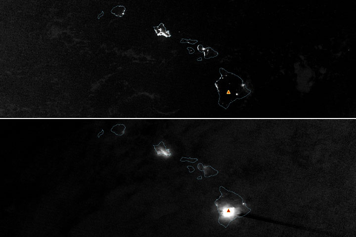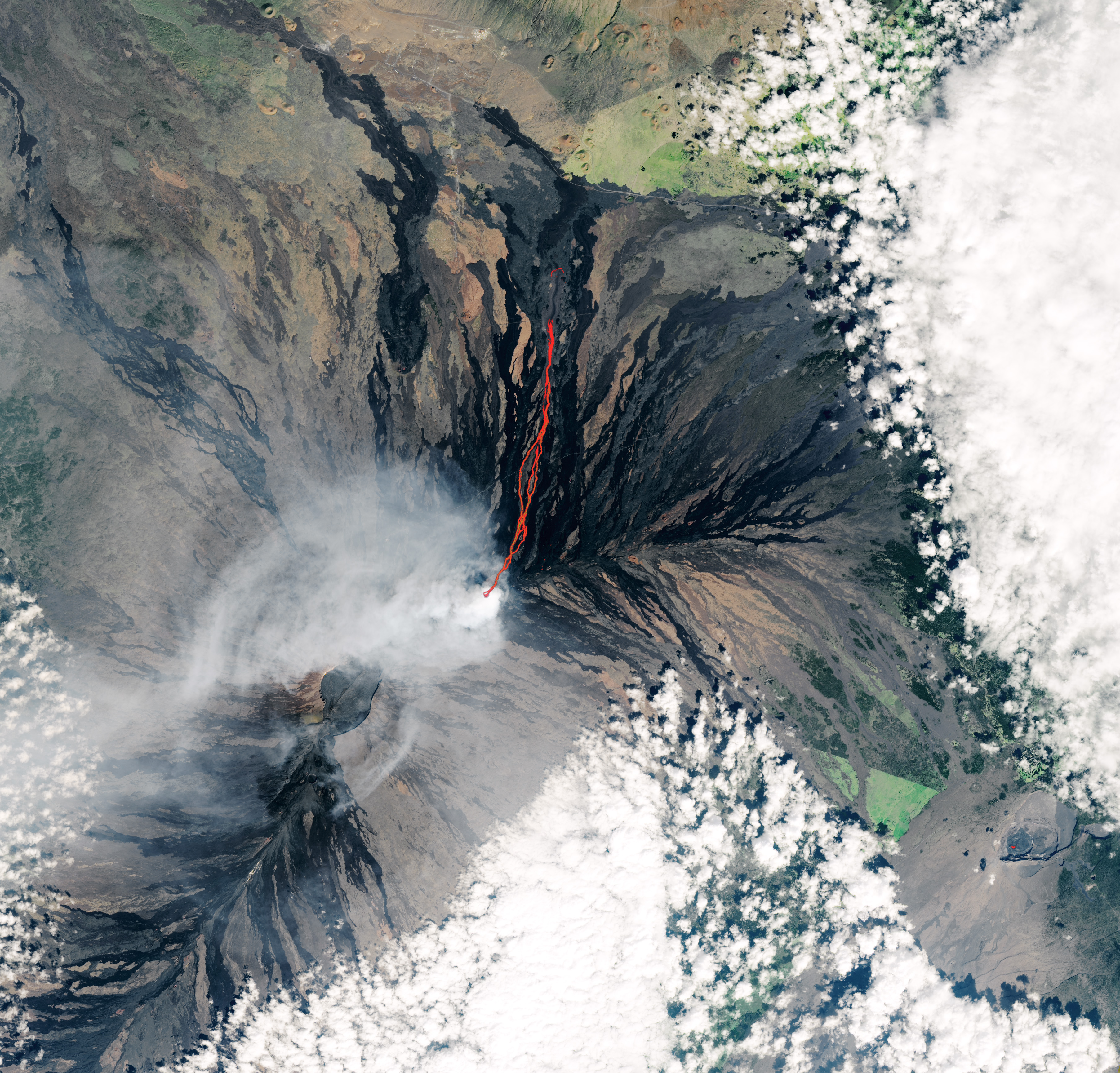
When Hawaii’s massive Mauna Loa volcano began erupting for the first time in nearly four decades late on November 27, 2022, lava initially spilled from the Moku’āweoweo crater at the mountain’s summit. But by the next morning, activity had migrated to a cluster of four fissures northeast of the summit. One of these—fissure 3—quickly became dominant, producing a long lava flow that spanned more than 10 kilometers (6 miles) after just a few days.
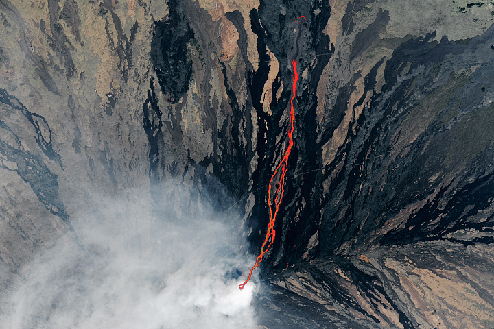
On December 2, 2022, the Operational Land Imager-2 (OLI-2) on Landsat 9 acquired this natural-color image of the erupting volcano. At the time, lava from fissure 3 was moving north toward Saddle Road, a key artery that connects the eastern and western sides of the island and provides access to the slope of Mauna Loa and Mauna Loa Observatory. The image is overlaid with infrared data from OLI-2 showing the location of warm areas associated with lava. A cloud of volcanic gas is visible wafting around the fissure.
More subtle but also visible in the Landsat image are warm areas associated with cooling lava from fissure 4. That flow is about two kilometers west of fissure 3. During the first few days of the eruption, fissure 4 was on a path that posed a potential threat to a small analog space research station that is part of the NASA-funded Hawai’i Space Exploration Analog and Simulation (HI-SEAS) project.
Though the station’s dome-shaped habitat wasn’t occupied when Mauna Loa erupted, multiple crews have lived and worked in it for missions lasting up to a year to help mission planners understand what astronauts exploring the surface of Mars or the Moon and living for long periods in cramped quarters would need to thrive. The most recent mission concluded in May 2022.
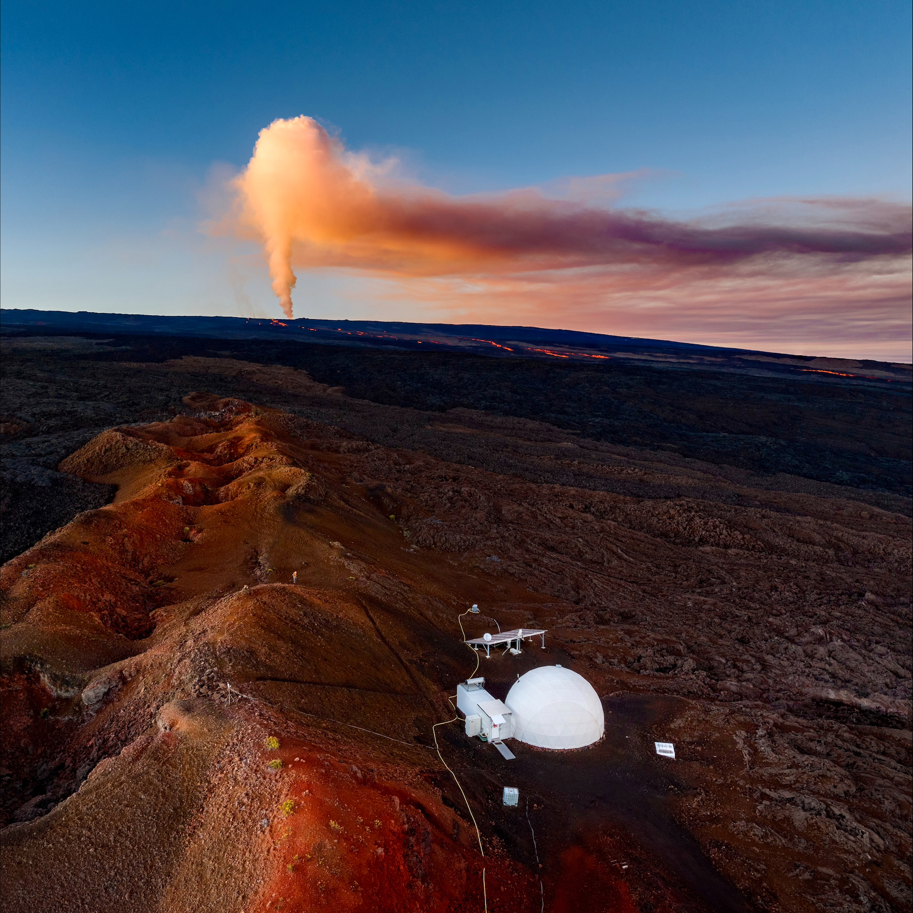
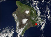
“The flow from fissure 4 looked threatening initially, but it has stalled out for now, and it looks like the flow from fissure 3 has settled into its path about half a mile to the west of the hab,” said former HI-SEAS principal investigator Kim Binstead. The photo above, taken by a drone operated by biologist Jordan Lerma, shows the habitat with the fissure 3 lava flow and a plume of volcanic emissions in the background on December 3, 2022. “Now we’re hoping that neither the Saddle Road nor the Mauna Loa Observatory access road get cut off by lava flows,” Binstead said.
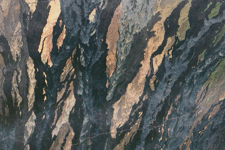
The habitat’s location on an active volcano and geologically young lava flows was intentional. The site was chosen based on its relative remoteness and its similarities to terrain on Mars. The red planet has large, gently sloping shield volcanoes with exposed lava flows that are geologic cousins to Mauna Loa. The image below, captured by the Operational Land Imager (OLI) on Landsat 8 on December 12, 2017, shows the habitat nestled amid fields of contrasting lava flows. The youngest flows are dark black; older, more weathered flows are shades of gray, brown, and red.
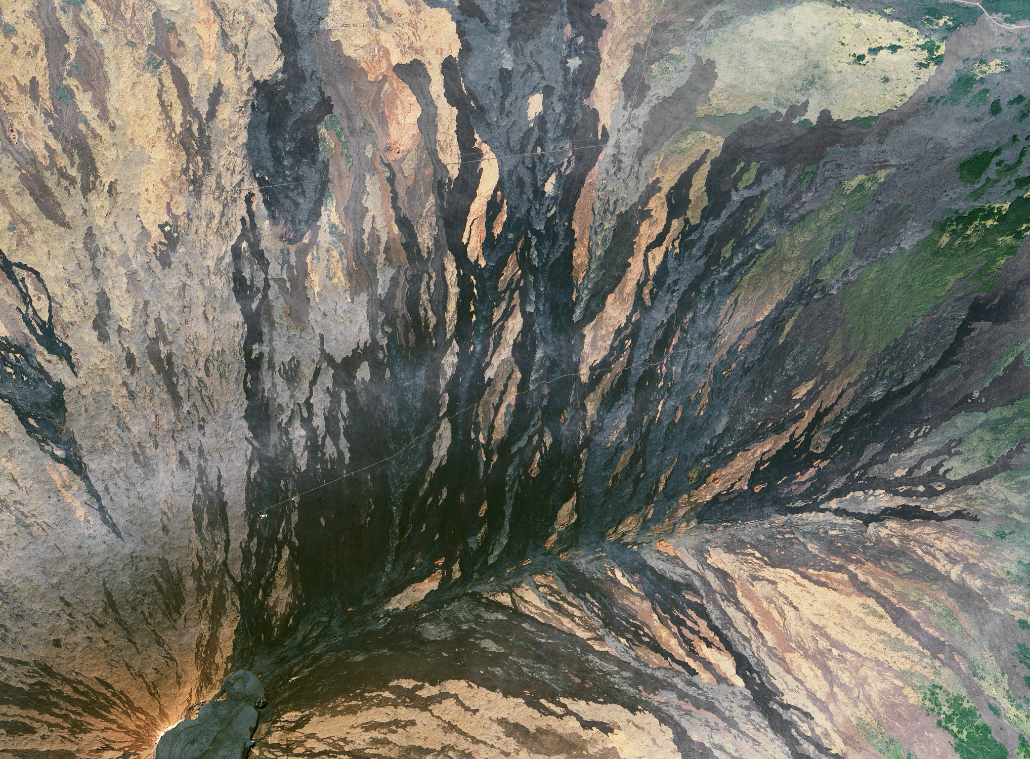
The habitat sits directly on the Pu‘ukā hilikū flow, which erupted about 1,800 years ago. That makes it significantly older than the nearby ‘Āinahou flow, which formed 450 years ago. The youngest flow near the habitat—one of the darkest in the image—erupted in 1899.
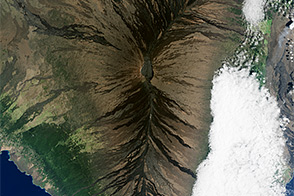
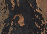
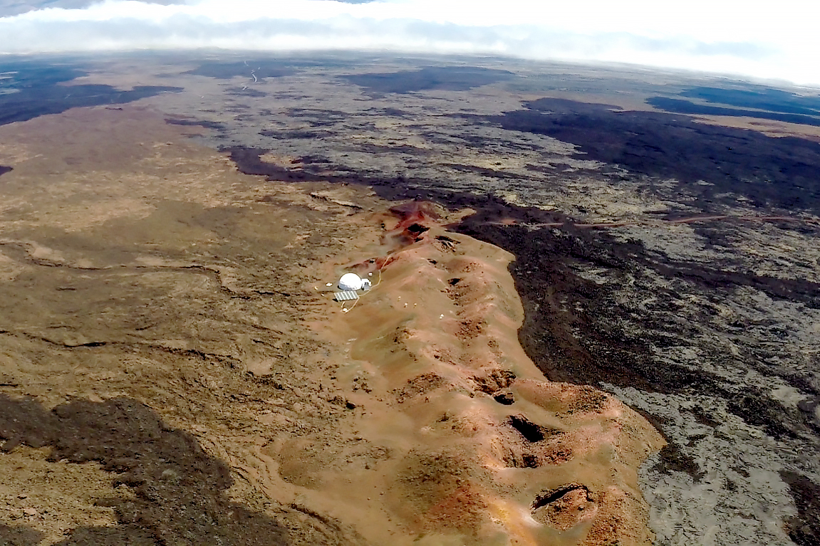
If lava does make its way toward the HI-SEAS site again, the local terrain might provide some buffer. “The station is built on the side of a ridge, which could offer some protection depending on the direction and speed of the flow,” explained recent HI-SEAS director Michaela Musilova. “But the facility would likely be destroyed if a lava flow were to come in direct contact with it.” The photograph below, taken in 2016 from a drone operated by HI-SEAS participant Andrzej Stewart, shows the spatter rampart ridge, which formed during an earlier eruption along an eruptive fissure as blobs of lava flew out, piled up, and cooled.
There is no failsafe way of forecasting how the eruption might progress, but former HI-SEAS geology director and current U.S. Geological Survey scientist Brian Shiro said there are hints that the Mauna Loa eruption may be winding down. “The effusion rate has slowed, and fountaining from fissure 3 has become irregular over the past few days,” he said. “Anything is possible, but I doubt that lava will reach Saddle Road. It’s also quite unlikely that fissure 4 will become reactivated during this eruption, so the HI-SEAS habitat seems to be safe for now.”
NASA Earth Observatory images by Lauren Dauphin, using Landsat data from the U.S. Geological Survey. Aerial photographs courtesy of Jordan Lerma and Andrzej Stewart. Story by Adam Voiland