
NASA researchers used satellite observations to create a damage proxy map (DPM) to help identify damaged buildings and infrastructure from the severe weather and tornadoes that hit Kentucky and surrounding states on Dec. 10, 2021.
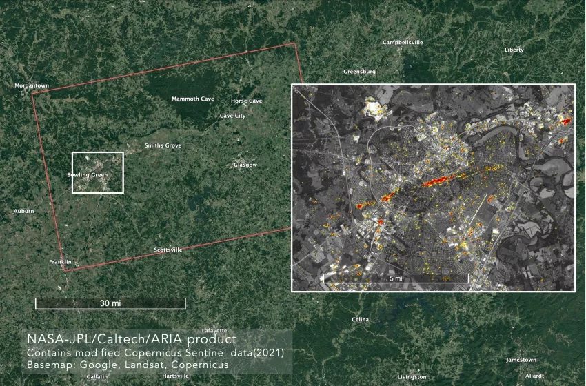
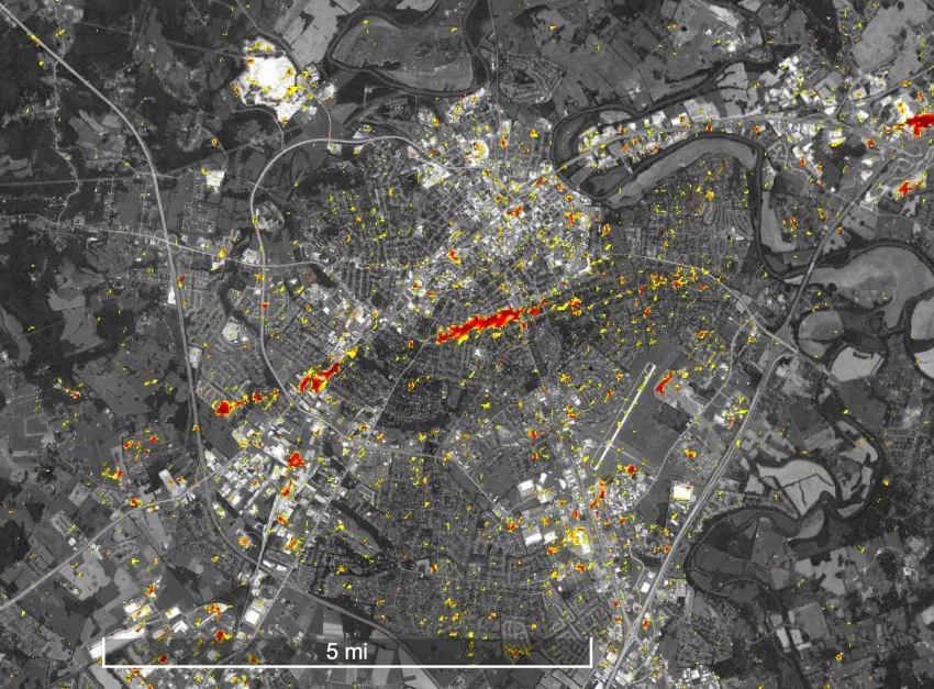
The Advanced Rapid Imaging and Analysis (ARIA) team at NASA's Jet Propulsion Laboratory and California Institute of Technology in Southern California created the map using multiple ESA Copernicus Sentinel-1 synthetic aperture radar (SAR) observations from before (between June 26, 2021 and Nov. 17, 2021) and after (Dec. 11, 2021) the event. The damage detection covers an area of 53 by 35 miles (86 by 57 km), as shown by the large red polygon. The inset in the above image (shown separately below) zooms in to show details of damage to the city of Bowling Green, Kentucky. Each pixel of damage detection measures about 30 meters across, with yellow to red indicates increasingly more significant surface change. Preliminary validation of the data was done by comparing it with the media reports and drone images of the damage. The DPM can be used as guidance to help identify damaged areas, but some false positives are possible, especially over vegetated areas. The map is most sensitive to building damage, but small-scale change or partial structural damage may not be detected in some cases. The work was funded in part by the NASA ROSES A.37 research project "Global Rapid Damage Mapping System with Spaceborne SAR Data".
NASA’s Disasters program is providing these data and imagery to regional stakeholders, and they are available for users to download on the NASA Disasters Mapping Portal and from the ARIA Share website. Disaster response teams can use these DPM’s to help identify buildings and infrastructure that may have been damaged, which can aid in determining where to send recovery teams and emergency resources.
NASA continues to work with FEMA, the National Weather Service, and other stakeholders, to support recovery from the tornadoes using Earth-observing data, and to monitor and aid response for the additional severe weather that has been hitting the U.S. this week.


