


Less than three months into its mission, NASA’s Ice, Cloud and land Elevation Satellite-2, or ICESat-2, is already exceeding scientists’ expectations. The satellite is measuring the height of sea ice to within an inch, tracing the terrain of previously unmapped Antarctic valleys, surveying remote ice sheets, and peering through forest canopies and shallow coastal waters.
With each pass of the ICESat-2 satellite, the mission is adding to datasets tracking Earth’s rapidly changing ice. Researchers are ready to use the information to study sea level rise resulting from melting ice sheets and glaciers, and to improve sea ice and climate forecasts.
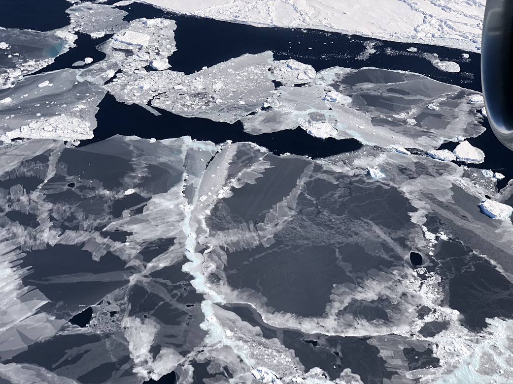
In this image, sea ice forms in the open water between floes, called leads, in the Bellingshausen Sea. ICESat-2 is able to detect the thin sea ice, allowing scientists to more accurately track seasonal ice formation.
Image Credit: NASA/Kate Ramsayer