Apollo 17 - Eugene Cernan working at the Rover.Image Credit: NASA/Jack Schmitt (assembled by Mike Constantine)
- NASA Posters and Other Resources -
Apollo 12 Comic Book
Download Web Resolution (4 MB PDF)
Download Print Resolution (25 MB PDF)
Posters

Download Poster (1.1 MB PDF)

Download Poster (1.1 MB PDF)

Download Poster (1.42 MB PDF)
Download Poster (1.71 MB PDF)
Download Patch (137 KB PDF)
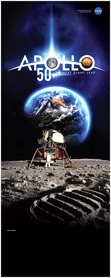
Download Banner (7.24 MB PDF)This is a high resolution image for printing. (36.42 x 90.67 inches)May not open in some browsers. Save to hard disk and use Acrobat Reader to view.
Paper Moon Cut-out
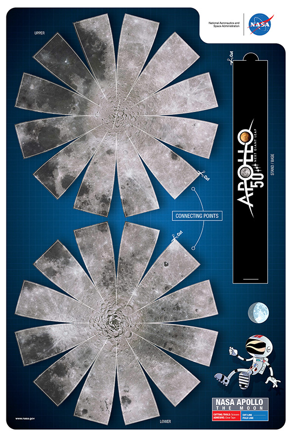
Download Paper Moon Cut-out (2.1 MB PDF)
Apollo 50th Logo
3D Models of Lunar Landing Sites to Print
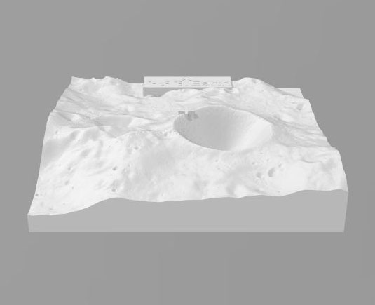
Using topography data derived from the Lunar Reconnaissance Orbiter and the SELENE mission, this model shows the Sea of Tranquility region surrounding the Apollo 11 landing site. The braille inscription on the sides reads “Apollo 11 Moon landing site at Sea of Tranquility.” The entire mission where Neil Armstrong and Buzz Aldrin walked on the lunar surface took place within a round bump at the center of the print.
Download 3D Model (27 MB)
Using topography data derived from the Lunar Reconnaissance Orbiter and the SELENE mission, this model shows the Sea of Tranquility region surrounding the Apollo 11 landing site. The vertical exaggeration of this print is 2x (double).
Download 3D Model (24 MB)
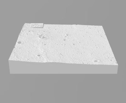
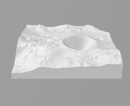
Using topography data derived from the Lunar Reconnaissance Orbiter’s Narrow Angle Camera, this model gives a zoomed in look at the Apollo 11 landing site. Because this topography data is so highly resolved, you can feel the descent module of the Apollo 11 mission, which is still on the lunar surface, as a small bump near the model’s center. The astronauts still only traveled to the small crater immediately to the lander’s right! This model is 1100 meters wide by 900 meters tall, and the vertical exaggeration is 3x.
Download 3d Model (20 MB)
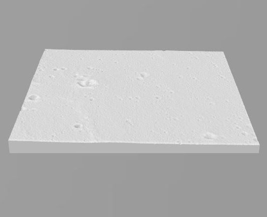
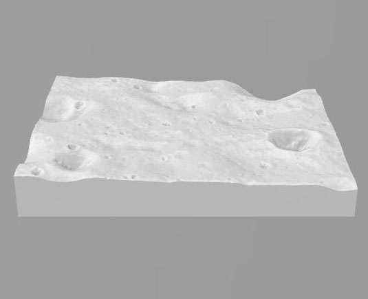
This model simulates the lunar surface at the Apollo 11 landing site. Fresh and degraded crater shapes are added to the model based on the locations of craters visible in images from the Lunar Reconnaissance Orbiter’s Narrow Angle Camera. During Apollo 11, the astronauts covered the all the area within the raised rim. Notably, Neil Armstrong walked the ~50 m from the lander to the large crater at the right, Little West Crater. Small bumps on the surface outside of where Neil and Buzz walked represent boulders. Three bumps inside the rim are science instruments and the largest bump is the lander’s location. There is no vertical exaggeration in this model.
Download 3D Model (17 MB)
Using topography data derived from the Lunar Reconnaissance Orbiter’s Lunar Orbiter Laser Altimeter, this model shows the South Pole of the Moon. The South Pole is marked with a lifted cross in the center of the print. Of note is the large crater, Shackleton, which likely hosts water-ice deposits. The direction of the Earth is marked, and a braille inscription on the model sides reads “NASA will land Americans on Moon’s South Pole”.
Download 3D Model (27 MB)
Using topography data derived from the Lunar Reconnaissance Orbiter’s Lunar Orbiter Laser Altimeter, this model shows the South Pole of the Moon. The South Pole itself is at the center of the model. Of note is the large crater, Shackleton, which likely hosts water-ice deposits.
Download 3d Model (24 MB)
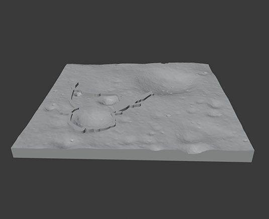
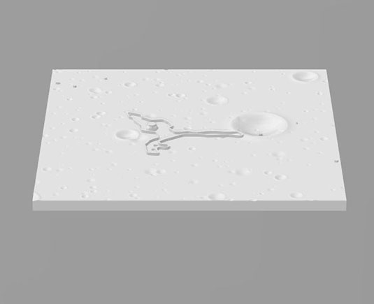
This topographic model of the Apollo 12 landing site shows where Pete Conrad and Al Bean walked (the raised path) during their two EVAs. The crew descended to the edge of Surveyor Crater and a raised bump marks their lunar module’s landing spot. The first EVA was to the northeast toward the large crater, Middle Crescent, where the ALSEP science instruments were set out. During the second EVA, the astronauts circled Surveyor Crater and visited the Surveyor 3 lander that landed two and a half years earlier at the site.
This model of the Apollo 12 landing site uses new topography data derived from the Lunar Reconnaissance Orbiter’s Narrow Angle Camera and traverses mapped by Schwagmeier and Jones (https://www.hq.nasa.gov/alsj/a12/a12.html) also using photographs from the Narrow Angle Camera. This model is 1 km on each side, and the vertical exaggeration is 2x (double).
Download 3D Model (26 MB)
Astromaterials 3D Project
Check out the first lunar sample picked up on the Moon in interactive 3D.
Astromaterials 3D Project Webpage
Historical Resources
Apollo 7-10 Finding Aid (907 KB PDF)
NASA History Office Apollo Links
Apollo by the Numbers: An extensive statistical reference.
Apollo by the Numbers (32 MB PDF)
Apollo by the Numbers - Table of Contents (HTML).
Educational Resources
Lunar and Planetary Institute's Apollo 50th Web PageApollo information with some posters and graphics.
Challenger Center, in partnership with NASA and our Challenger Learning Centers, is celebrating the Moon landing anniversary. Planned activities include the distribution of several new, Moon-focused programs for students:
- Let’s Launch! – A Flipped Classroom course that includes animated videos explaining Moon concepts and complementary hands-on activities. https://www.challenger.org/challenger_lessons/letslaunch/
- Next Giant Leap – Activities that take students through seven phases of a Lunar Exploration: preparing for launch, rocket launching, lunar landing, the Moon phases, lunar geology, lava tube exploration, and programming a lunar rover. https://www.challenger.org/challenger_lessons/the-next-giant-leap/
- Challenger Rover App - Students assemble a digital rover according to given specifications, then use block coding to program it to navigate the surface of the Moon to a designated location. Students will also program the rover to conduct experiments and gather data. https://www.challenger.org/challenger_lessons/the-next-giant-leap/
These resources are based upon work supported by NASA under agreement number NNX16AD70A. Any opinions, findings, and conclusions or recommendations expressed in this material are those of Challenger Center and do not necessarily reflect the views of the National Aeronautics and Space Administration.
LROC Apollo 11 Footsteps Relive the Apollo 11 surface traverse. The Lunar Reconnaissance Orbiter Camera, or LROC, is a system of three cameras mounted on the Lunar Reconnaissance Orbiter (LRO) that capture high resolution black and white images and moderate resolution multi-spectral images of the lunar surface.