


Sometimes a flash is needed to illuminate the scene to allow a camera to capture a good photo; a new entry, descent, and landing technology could do the same for spacecraft traveling to the Moon or other planets and then returning home to Earth.
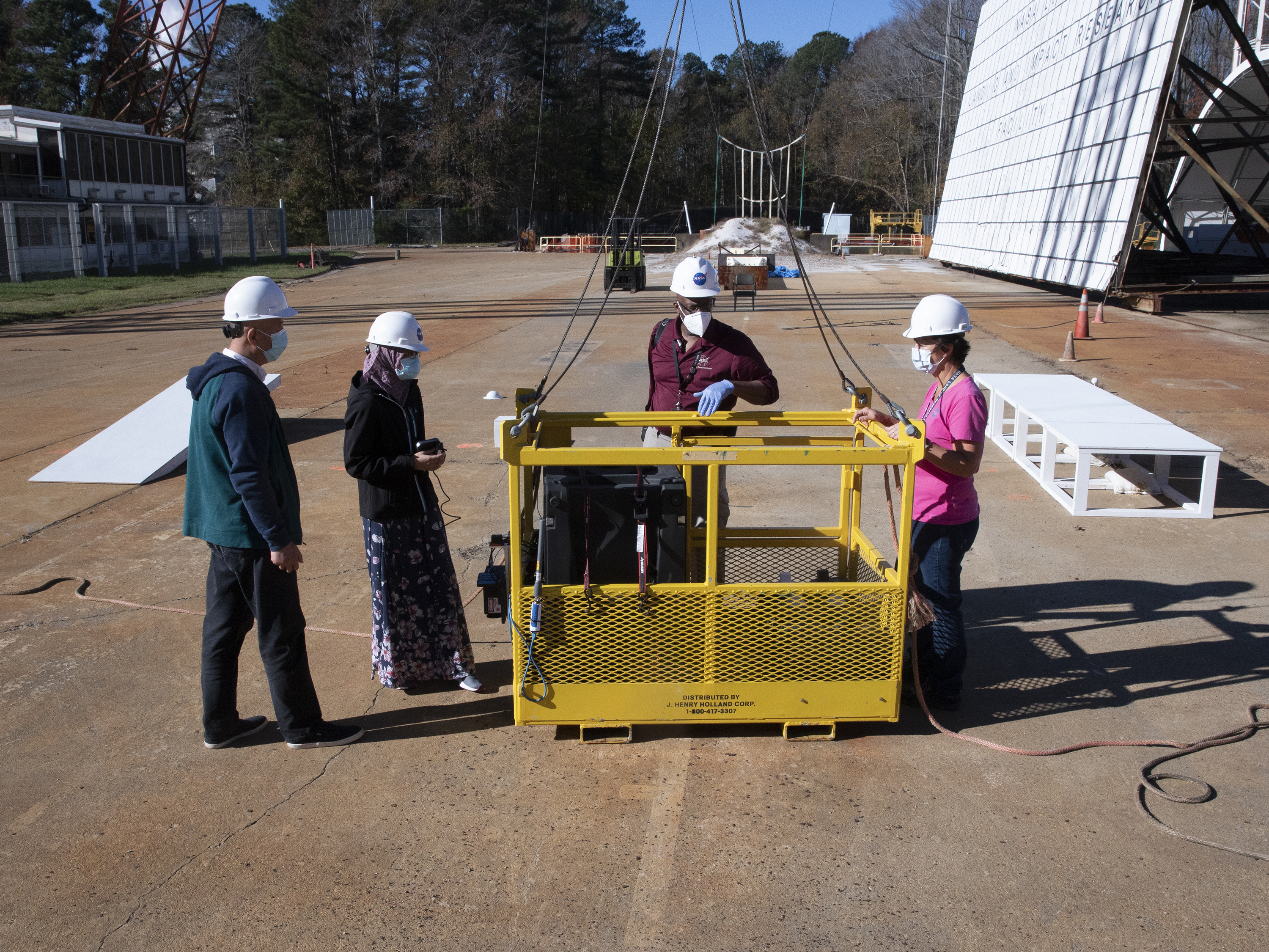
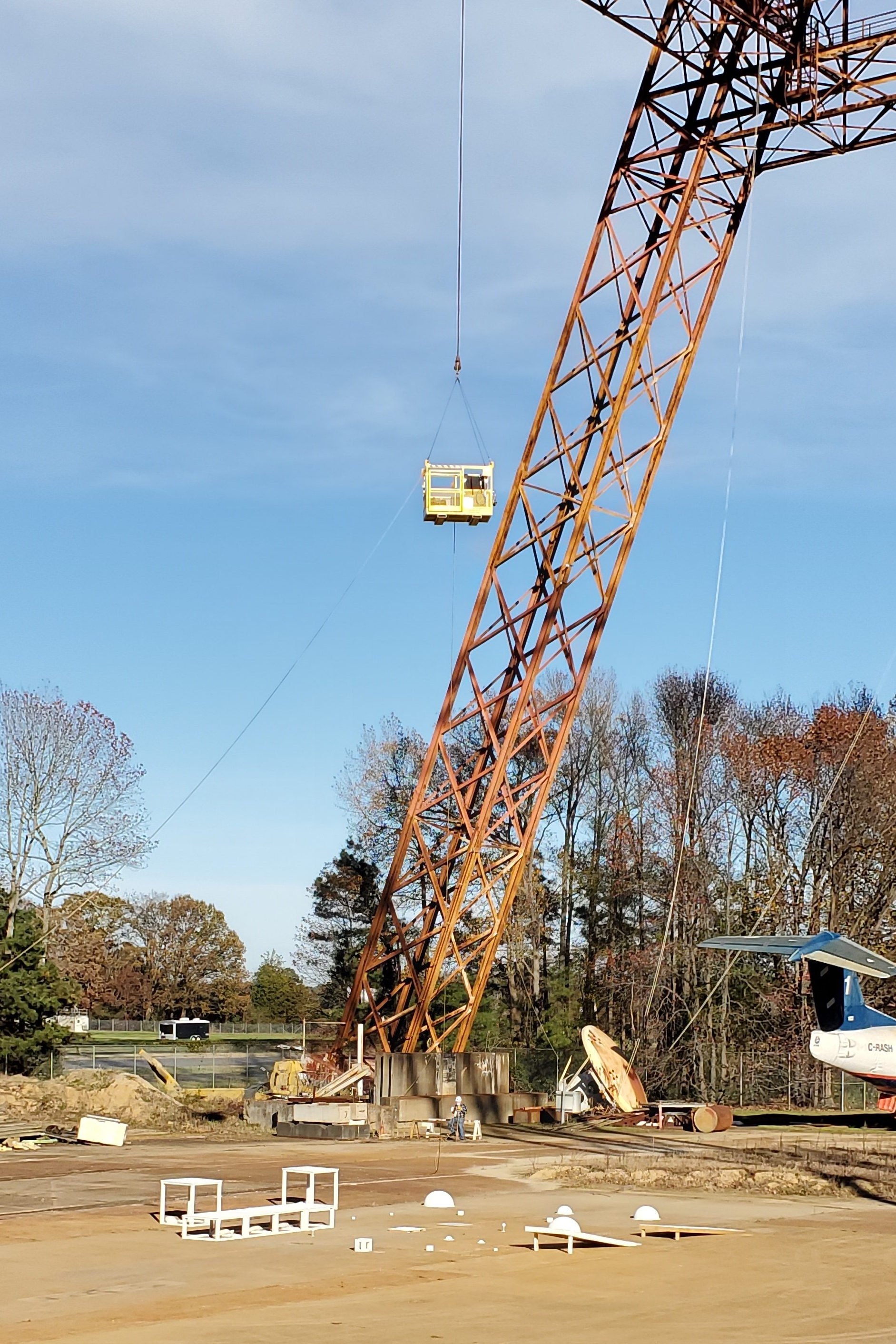
Researchers at NASA’s Langley Research Center in Hampton, Virginia, worked with Blue Origin of Kent, Washington, to test flash lidar technology at the center’s Landing and Impact Research Facility, or gantry. The testing is part of a Tipping Point partnership with Blue Origin, supported by NASA’s Space Technology Mission Directorate, to test a suite of lunar landing technologies in support of the agency’s Artemis program.
Flash lidar creates a digital elevation map using a laser, which would normally be pencil thin, but instead is diffused and spread out to a 10-to-15-degree angle to illuminate a section of terrain. The sensor is an array of pixels and each pixel is covering a small spot on the ground. When the laser is pulsed the flash energy bounces off the surface and returns to the sensor.
“Flash lidar 3D images allow you to find a safe landing zone within an area the size of a football field,” said Byron Meadows, laser systems engineer and flash lidar project manager at Langley. “Landers can be top heavy, and it doesn’t take much to tip over, so landing a leg in a crater or on a boulder is the kind of thing that has to be avoided. And if we go to Titan, a moon of Saturn, it’s so gaseous you won’t see ground until you get there.”
The partnership with Blue Origin is a follow on to ALHAT, when early versions of navigation Doppler lidar and flash lidar were tested together. During the development of the technology researchers found available hardware systems didn’t have the resolution to map a large area from high enough off the ground. That’s where the NASA-developed super resolution algorithm comes in.
“Your retina is like a screen, but your optic nerve goes through your eye so you technically have a black spot in your field of view, you just don’t see it because your eye jitters and your brain fills in the gaps,” Meadows said. “That is sort of what super resolution does. It takes advantage of the vehicle movement and fills in the gaps with measurements to get more detail.”
The recent tests at Langley paired commercially available hardware with the NASA algorithm. Simulated targets were placed under the gantry at a range of heights and spaced at various distances from each other. The lidar was placed in a basket and raised and lowered using a winch, pulling machine, from the top of the gantry over the hazard field like it was descending towards the Moon.
“It was a simple test but looking at the entire field of view using a semi-realistic landing site gave us great data,” Meadows said. “The gantry is such an incredibly unique facility with a long history of being used for this very purpose, to improve landing technologies.”
Being advanced alongside one another, flash lidar and navigation Doppler lidar could work together to help safely and precisely land astronauts and robots on future deep space missions.
“The two systems are very complimentary. Navigation Doppler lidar gives the velocity and position data and the flash lidar is really a 3D video camera that looks at the terrain as the lander comes in,” said Farzin Amzajerdian, navigation Doppler lidar and flash lidar principal investigator at Langley. “It sees the hazards below, generates a map, and the algorithm figures out where the best location is to land. Once you have that location you need navigation Doppler lidar to precisely land there. Together it’s a powerful suite.”