Landsat Next Defined

Landsat Next Defined

Landsat Next is on the horizon—the new mission will not only ensure continuity of the longest space-based record of Earth’s land surface, it will fundamentally transform the breadth and depth of actionable information freely available to end users. Take a look at the new capabilities that will define the next Landsat mission.

Read More »

Expanding OpenET Across Amazon Basin

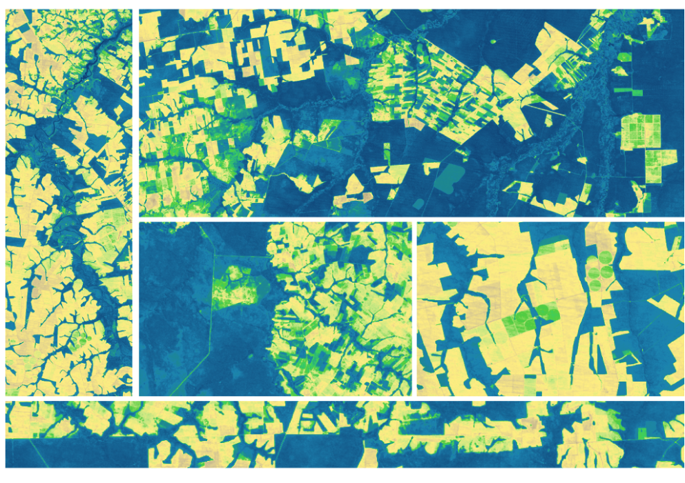
The research teams who help sustain the largest freshwater reserve in the world are developing a new tool to promote more resilient farming systems in Brazil. The goal is to help farmers better handle changes in the water cycle, deal with droughts, and adapt to a changing climate.

Read More »
Landsat Next Defined

Landsat Next Defined

Landsat Next is on the horizon—the new mission will not only ensure continuity of the longest space-based record of Earth’s land surface, it will fundamentally transform the breadth and depth of actionable information freely available to end users. Take a look at the new capabilities that will define the next Landsat mission.

Read More »

Expanding OpenET Across Amazon Basin

The research teams who help sustain the largest freshwater reserve in the world are developing a new tool to promote more resilient farming systems in Brazil. The goal is to help farmers better handle changes in the water cycle, deal with droughts, and adapt to a changing climate.

Read More »

“The really unique part about the Landsat record is the fact that it goes back to the ’70s. I can’t imagine what it would be like to describe what this volcano did without having a timeseries of Landsat. There is no other asset in the sky that can show us what Landsat does in terms of the effect of this eruption and also the effect of recovery following the eruption.”


“Landsat is really important because it gives us that time component. We can go back in time and see what an area let’s say a coastal zone or a mangrove forest has been like over time.”


“Landsat sees the earth in a unique way. It takes images of every location in the world to reveal earth’s secrets, from volcanic activity to urban sprawl.”


“A half-century archive of Landsat’s Earth observations is a magnificent achievement in the history of science. This fifty-year record gives scientists a consistent baseline that can be used to track climate change and enables them to see changes to the land that might not otherwise be noticed.”


“The resolution of Landsat imagery and the size of the Landsat database enables critical insight for scalable, high resolution flood detection in several key ways… This increased resolution is particularly critical in urban areas.”


“This is an example of something government can do well: investing in infrastructure that broadly benefits society, and provides a stable platform for the development of businesses and economic activity. Landsat is the data equivalent of the interstate highway system, a public good that has spawned a thriving for-profit remote sensing industry in the US and beyond.”


“A growing archive of Landsat images allow us to see how quickly icesheets are changing.”


“Landsat, now one of the largest and most powerful tranches of Earth-science data, is an invaluable scientific resource.”


“One of the most powerful capabilities we can offer is a continuous global view of our planet. Without the observations of land, precipitation, the atmosphere, and our oceans, we would be flying blind in terms of what trends have been and how we can improve of our models for the future.”


“The majority of tropical countries are using Landsat imagery as the primary source of information to support their forest change assessments.”


“For our main aim of quantifying surface water extent dynamics during a period of high hydro-climatic variability, Landsat was the only satellite archive to meet all our criteria.”


“Landsat 5 is kind of like the (Energizer) bunny — it just keeps running and running.”


“The first step of ecosystem accounting is to actually map the dynamics of ecosystems over time.”


“Nothing is harder to image than the past. It is imperative that all Landsat observations are archived and made available to users.”


“Even though I have a book coming out about the Moon Landing, I’ll say it: Landsat is likely the greatest, most impactful, yet under-appreciated, accomplishment of the entire space age.”


“The success of a mission, and the societal benefits it creates, relies on many factors, including design, manufacture, launch, and operation of the sensor. However, it also includes data acquisition, accessibility, availability, and continuity, all of which are embodied by the Landsat program.”


“What makes this [Landsat 8] mission team special is the fervor they brought to task. They were challenged to retain the historic data continuity, yet take advantage of new technology while balancing cost and complexity. Few, if any, missions face such a challenge with such consequences on the line. After more than a decade of dedication, this Team launched a new sensor that was more sensitive and robust than previous sensors, and provided not only data continuity but even more and better d…


“The Landsat program provides an unparalleled historical record of coastal observations that captures how the world’s coastlines have changed over time in incredible detail.”


“The relatively high spatial detail from Landsat allows differentiation of water use by crop type and individual farm field. At the moment, only Landsat can provide a consistent historical data going back to the 1980s that is long enough for trend analysis and investigate the relationships between management decisions and climatic drivers.”


“Landsat 8 is part of a revolution of how much remote sensing can do to track the polar areas.”


“Having Landsat 9 in progress, and a long-term commitment to sustainable land imaging, is great for natural resource science and for data-driven industries such as precision agriculture and insurance.”


“I’m grateful that NASA, USGS, and scientists like William Pecora had the foresight to begin collecting Earth observations a half century ago.”


“Our mapping techniques build on the historical Landsat record to provide highly needed information on regional scale and this helps in evaluating subtle changes in mangroves over a long period of time (trends) and to detect sudden changes due to natural catastrophes or dramatic anthropogenic impacts… [and] Thanks to the increased abundance of Landsat satellite images, it is becoming progressively easier to collect available images of mangrove habitats captured at low tide and high tide.”


“You can launch a new satellite, but you can’t put something up in the past. Landsat will always be that historic record that new satellites can tie themselves to.”


Landsat 9 bw
Landsat 9 bw
Landsat 9 bw

The NASA/USGS Landsat Program provides the longest continuous space-based record of Earth’s land in existence. Landsat data give us information essential for making informed decisions about Earth’s resources and environment.