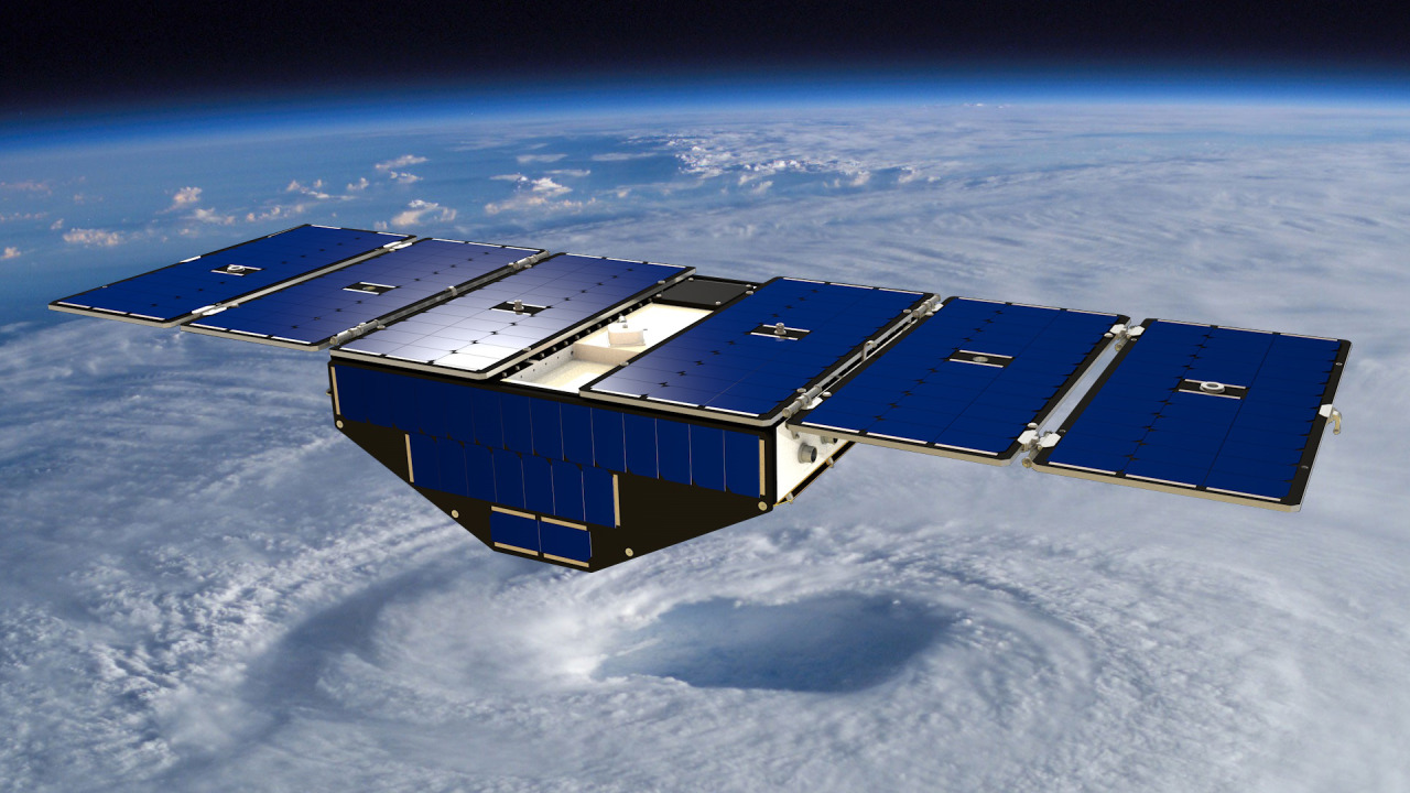
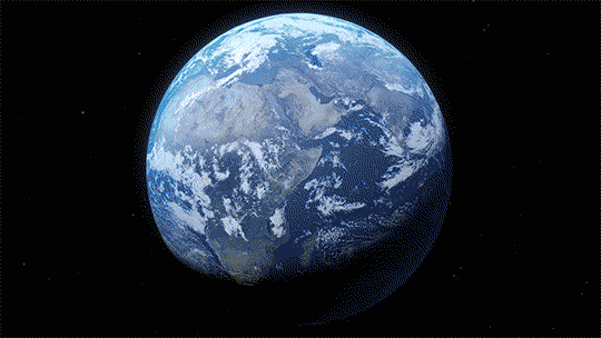
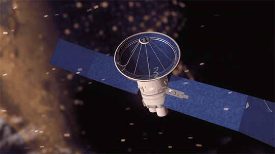
The same GPS technology that helps people get where they’re going in a car will soon be used in space in an effort to improve hurricane forecasting. The technology is a key capability in a NASA mission called the Cyclone Global Navigation Satellite System (CYGNSS).
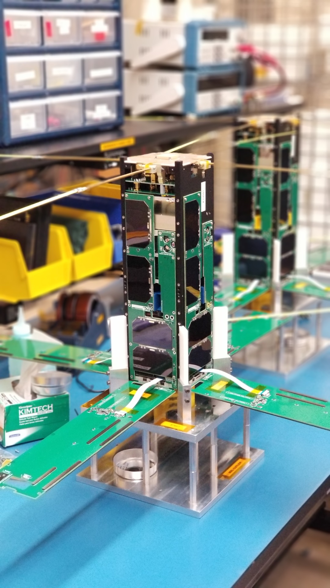
The CYGNSS mission, led by the University of Michigan, will use eight micro-satellite observatories to measure wind speeds over Earth’s oceans, increasing the ability of scientists to understand and predict hurricanes. Each microsatellite observatory will make observations based on the signals from four GPS satellites.
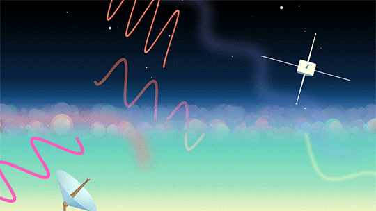
The CYGNSS microsatellite observatories will only receive signals broadcast directly to them from GPS satellites already orbiting the Earth and the reflection of the same satellite’s signal reflected from the Earth’s surface. The CYGNSS satellites themselves will not broadcast.
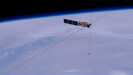
The use of eight microsatellite observatories will decrease the revisit time as compared with current individual weather satellites. The spacecraft will be deployed separately around the planet, with successive satellites passing over the same region every 12 minutes.
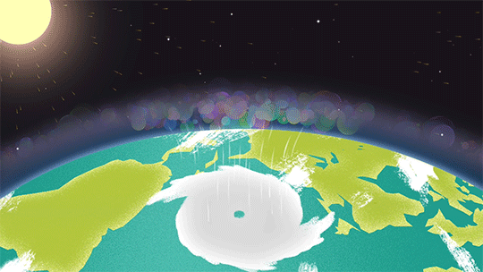
This will be the first time that satellites can peer through heavy tropical rainfall into the middle of hurricanes and predict how intense they are before and during landfall.
As the CYGNSS and GPS constellations orbit around the Earth, the interaction of the two systems will result in a new image of wind speed over the entire tropics every few hours, compared to every few days for a single satellite.
Another advantage of CYGNSS is that its orbit is designed to measure only in the tropics…where hurricanes develop and are most often located. The focus on tropical activity means that the instruments will be able to gather much more useful data on weather systems exclusively found in the tropics. This data will ultimately be used to help forecasters and emergency managers make lifesaving decisions.
Launch!
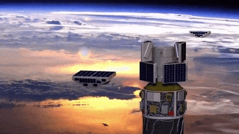
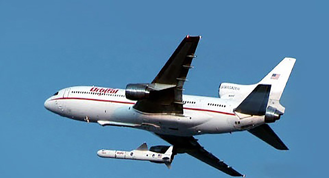
CYGNSS launched at 8:37 a.m. EST on Thursday, Dec. 15, from our Kennedy Space Center in Florida. CYGNSS launched aboard an Orbital ATK Pegasus XL rocket, deployed from Orbital’s “Stargazer” L-1011 carrier aircraft.
Pegasus is a winged, three-stage solid propellant rocket that can launch a satellite into low Earth orbit. How does it work? Great question!
After takeoff, the aircraft (which looks like a commercial airplane..but with some special quirks) flies to about 39,000 feet over the ocean and releases the rocket.
After a five-second free fall in a horizontal position, the Pegasus first stage ignites. The aerodynamic lift, generated by the rocket’s triangle-shaped wing, delivers the payload into orbit in about 10 minutes.
Pegasus is used to deploy small satellites weighing up to 1,000 pounds into low Earth orbit.
And success! The eight CYGNSS satellites were successfully deployed into orbit!
Just like your phone needs Wi-Fi or data services to text or call – NASA spacecraft need communication services.
Giant antennas on Earth and a fleet of satellites in space enable missions to send data and images back to our home planet and keep us in touch with our astronauts in space. Using this data, scientists and engineers can make discoveries about Earth, the solar system, and beyond. The antennas and satellites make up our space communications networks: the Near Space Network and Deep Space Network.
Check out the top ten moments from our space comm community:
ALT
1. Space communication networks helped the Artemis I mission on its historic journey to the Moon. From the launch pad to the Moon and back, the Near Space Network and Deep Space Network worked hand-in-hand to seamlessly support Artemis I. These networks let mission controllers send commands up to the spacecraft and receive important spacecraft health data, as well as incredible images of the Moon and Earth.
The Pathfinder Technology Demonstration 3 spacecraft with hosted TeraByte InfraRed Delivery (TBIRD) payload communicating with laser links down to Earth. Credit: NASA/Ames Research Center
2. Spacecraft can range in size – from the size of a bus to the size of a cereal box. In May 2022, we launched a record-breaking communication system the size of a tissue box. TBIRD showcases the benefits of a laser communications system, which uses infrared light waves rather than radio waves to communicate more data at once. Just like we have upgraded from 3G to 4G to 5G on our phones, we are upgrading its space communications capabilities by implementing laser comms!
ALT
3. The Deep Space Network added a new 34-meter (111-foot) antenna to continue supporting science and exploration missions investigating our solar system and beyond. Deep Space Station 53 went online in February 2022 at our Madrid Deep Space Communications Complex. It is the fourth of six antennas being added to expand the network’s capacity.
ALT
4. You’ve probably seen in the news that there are a lot of companies working on space capabilities. The Near Space Network is embracing the aerospace community’s innovative work and seeking out multiple partnerships. In 2022, we met with over 300 companies in hopes of beginning new collaborative efforts and increasing savings.
ALT
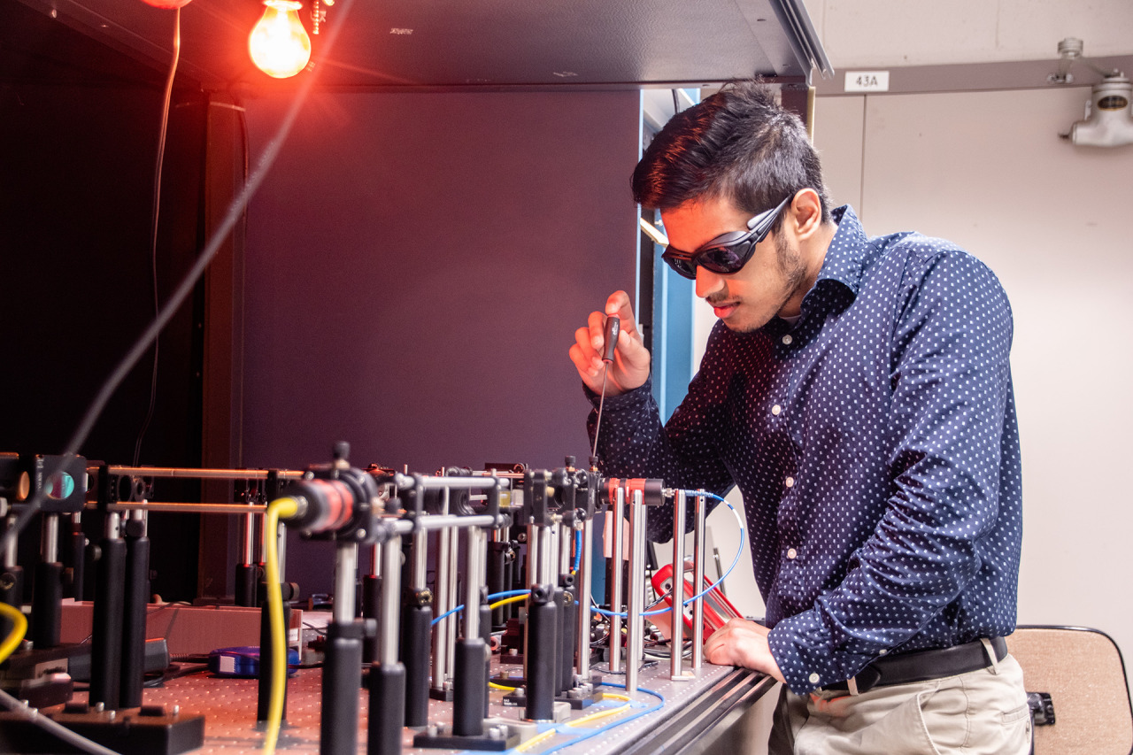
5. Similar to TBIRD, we’re developing laser comms for the International Space Station. The terminal will show the benefits of laser comms while using a new networking technique called High Delay/Disruption Tolerant Networking that routes data four times faster than current systems. This year, engineers tested and proved the capability in a lab.
ALT
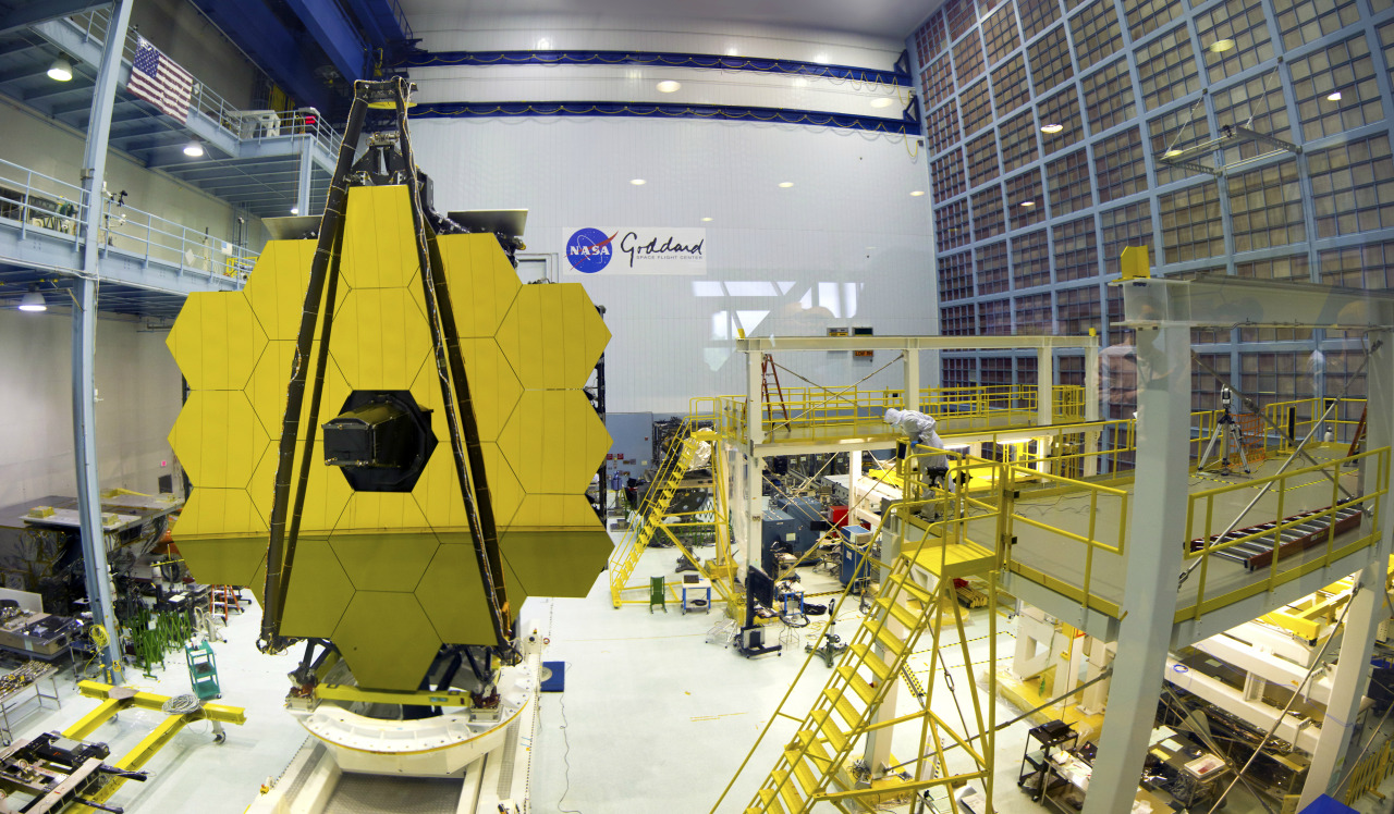
6. In 2021, we launched the James Webb Space Telescope, a state-of-the-art observatory to take pictures of our universe. This year, the Deep Space Network received the revolutionary first images of our solar system from Webb. The telescope communicates with the network’s massive antennas at three global complexes in Canberra, Australia; Madrid, Spain; and Goldstone, California.
ALT
7. Just like we use data services on our phone to communicate, we’ll do the same with future rovers and astronauts exploring the Moon. In 2022, the Lunar LTE Studies project, or LunarLiTES, team conducted two weeks of testing in the harsh depths of the Arizona desert, where groundbreaking 4G LTE communications data was captured in an environment similar to the lunar South Pole. We’re using this information to determine the best way to use 4G and 5G networking on the Moon.
ALT
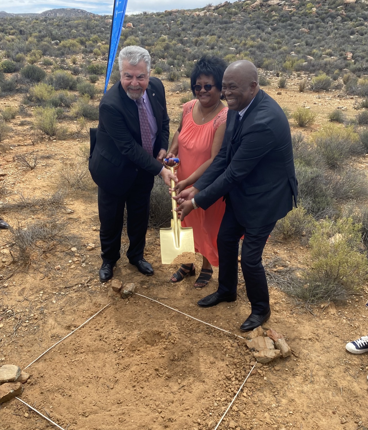
8. A new Near Space Network antenna site was unveiled in Matjiesfontein, South Africa. NASA and the South African Space Agency celebrated a ground-breaking at the site of a new comms antenna that will support future Artemis Moon missions. Three ground stations located strategically across the globe will provide direct-to-Earth communication and navigation capabilities for lunar missions.
ALT
9. Quantum science aims to better understand the world around us through the study of extremely small particles. April 14, 2022, marked the first official World Quantum Day celebration, and we participated alongside other federal agencies and the National Quantum Coordination Office. From atomic clocks to optimizing laser communications, quantum science promises to greatly improve our advances in science, exploration, and technology.
ALT
10. We intentionally crashed a spacecraft into an asteroid to test technology that could one day be used to defend Earth from asteroids. The Double Asteroid Redirection Test, or DART, mission successfully collided with the asteroid Dimorphos at a rate of 4 miles per second (6.1 kilometers per second), with real-time video enabled by the Deep Space Network. Alongside communications and navigation support, the global network also supports planetary defense by tracking near-Earth objects.
We look forward to many more special moments connecting Earth to space in the coming year.
When you think of NASA, you probably think of space. Which makes sense, because space is a huge part of what we do. That being said, here at NASA we are also involved in many other research areas, and even play a role in hurricane weather forecasting.
Our satellites, computer modeling, instruments, aircraft and field missions all contribute to a mix of information used by scientists to get a better understanding of these storms. Aspects of storms from rainfall rates to surface wind speed are all analyzed to help identify the potential for storm formation or intensification.
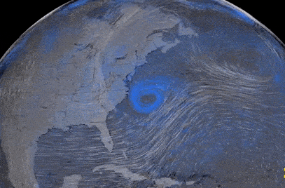
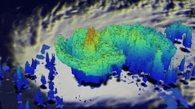
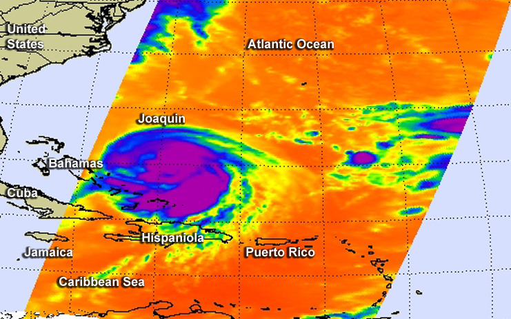
Currently, our satellites are passing overhead as Hurricane Joaquin (above) travels through the Atlantic Ocean. Our Global Precipitation Measurement, or GPM Core satellite captured images and rainfall rates of the storm. GPM showed a large area of very intense rain, which indicates that large amounts of heat are being released into the storm’s center. This fuels the circulation and provides the means for its intensification.
Maximum sustained winds have increased to near 80 mph and additional strengthening is expected. Joaquin could become a major hurricane during the next few days.
In 2016, we’re launching the Cyclone Global Navigation Satellite System (CYGNSS), which is a constellation of eight small satellites. With this launch, we will be able to better understand the rapid intensification of hurricanes, and improve hurricane intensity forecasts.
In addition to our satellite technology, we also conduct field missions to study hurricanes. In our most recent field mission, we investigated the process that underlie hurricane formation and intensity change in the Atlantic Ocean basin.
In the 50 years since the first Earth Day, the view from space has revolutionized our understanding of Earth’s interconnected atmosphere, oceans, freshwater, ice, land, ecosystems and climate that have helped find solutions to environmental challenges.
If NASA’s Earth science has changed this much in 50 years, what will it look like in 50 more years?
We asked some researchers what they thought. Here are their answers, in their own words.
Mahta Moghaddam is a professor of electrical and computer engineering at the University of Southern California. She’s building a system that helps sensors sync their measurements.
I am interested in creating new ways to observe the Earth. In particular, my team and I are building and expanding a system that will allow scientists to better study soil moisture. Soil moisture plays a vital role in the water and energy cycle and drives climate and weather patterns. When soil is wet and there is enough solar radiation, water can evaporate and form clouds, which precipitate back to Earth. Soil also feeds us – it nourishes our crops and sustains life on Earth. It’s one of the foundations of life! We need to characterize and study soil in order to feed billions of people now and in the future.
Our novel tool aims to observe changes in soil moisture using sensors that talk to each other and make decisions in real time. For instance, if one sensor in a crop field notes that soil is dry in a plot, it could corroborate it with other sensors in the area and then notify a resource manager or decision maker that an area needs water. Or if a sensor in another location senses that soil moisture is changing quickly due to rain or freeze/thaw activity, it could send a command to launch a drone or even to notify satellites to start observing a larger region. We live in one big, connected world, and can and will use many different scales of observations – local to global – from point-scale in-situ sensors to the scales that can be covered by drones, airplanes, and satellites. In just a few years from now, we might see much more vastly automated systems, with some touching not only Earth observations, but other parts of our lives, like drone deliveries of medical tests and supplies.
Odele Coddington is a scientist at the Laboratory for Atmospheric and Space Physics at the University of Colorado, Boulder. She’s building an instrument to measure how much solar energy Earth reflects back into space.
My research is focused on the Earth system response to the Sun’s energy. I spend half of my time thinking about the amount and variability of the Sun’s energy, also known as the solar irradiance. I’m particularly interested in the solar spectral irradiance, which is the study of the individual wavelengths of the Sun’s energy, like infrared and ultraviolet. On a bright, clear day, we feel the Sun’s warmth because the visible and infrared radiation penetrate Earth’s atmosphere to reach the surface. Without the Sun, we would not be able to survive. Although we’ve been monitoring solar irradiance for over 40 years, there is still much to learn about the Sun’s variability. Continuing to measure the solar irradiance 50 years from now will be as important as it is today.
I spend the other half of my time thinking about the many processes driven by the Sun’s energy both within the atmosphere and at the surface. I’m excited to build an instrument that will measure the integrated signal of these processes in the reflected solar and the emitted thermal radiation. This is my first foray into designing instrumentation and it has been so invigorating scientifically. My team is developing advanced technology that will measure Earth’s outgoing radiation at high spatial resolution and accuracy. Our instrument will be small from the onset, as opposed to reducing the size and mass of existing technology. In the future, a constellation of these instruments, launched on miniaturized spacecraft that are more flexible to implement in space, will give us more eyes in the sky for a better understanding of how processes such as clouds, wildfires and ice sheet melting, for instance, alter Earth’s outgoing energy.
Sujay Kumar is a research physical scientist at NASA’s Goddard Space Flight Center. He works on the Land Information System.
Broadly, I study the water cycle, and specifically the variability of its components. I lead the development of a modeling system called the Land Information System that isolates the land and tries to understand all the processes that move water through the landscape. We have conceptual models of land surface processes, and then we try to constrain them with satellite data to improve our understanding. The outputs are used for weather and climate modeling, water management, agricultural management and some hazard applications.
I think non-traditional and distributed platforms will become more the norm in the future. So that could be things like CubeSats and small sats that are relatively cheaper and quicker than large satellites in terms of how much time it takes to design and launch. One of the advantages is that because they are distributed, you’re not relying on a single satellite and there will be more coverage. I also think we’ll be using data from other “signals of opportunity” such as mobile phones and crowd-sourced platforms. People have figured out ways to, for example, retrieve Earth science measurements from GPS signals.
I feel like in the future we will be designing our sensors and satellites to be adaptive in terms of what the observational needs on the ground are. Say a fire or flood happens, then we will tell the satellite to look over there more intensely, more frequently so that we can benefit. Big data is a buzzword, but it’s becoming a reality. We are going to have a new mission call NISAR that’s going to collect so much data that we really have to rethink how traditional modeling systems will work. The analogy I think of is the development of a self-driving car, which is purely data driven, using tons and tons of data to train the model that drives the car. We could possibly see similar things in Earth science.
In space, invisible, fast-moving particles from the Sun and other sources in deep space zip around, their behavior shaped by dynamic electric and magnetic fields. There are so few of these particles that space is considered a vacuum, but what’s there packs a punch. Together, we call all of this invisible activity space weather — and it affects our technology both in space and here on Earth.
This month, two new missions are launching to explore two different kinds of space weather.
Scrambled signals
Many of our communications and navigation systems — like GPS and radio — rely on satellites to transmit their signals. When signals are sent from satellites down to Earth, they pass through a dynamic zone on the upper edge of Earth’s atmosphere called the ionosphere.
Gases in the ionosphere have been cooked into a sea of positive- and negative-charged particles by solar radiation. These electrically charged particles are also mixed in with neutral gases, like the air we breathe. The charged particles respond to electric and magnetic fields, meaning they react to space weather. Regular weather can also affect this part of the atmosphere.
Influenced by this complicated web of factors, structured bubbles of charged gas sometimes form in this part of the atmosphere, particularly near the equator. When signals pass through these bubbles, they can get distorted, causing failed communications or inaccurate GPS fixes.
Right now, it’s hard to predict just when these bubbles will form or how they’ll mess with signals. The two tiny satellites of the E-TBEx mission will try to shed some light on this question.
As these CubeSats fly around Earth, they’ll send radio signals to receiving stations on the ground. Scientists will examine the signals received in order to see whether — and if so, how much — they were jumbled as they traveled through the upper atmosphere and down to Earth.
All together, this information will give scientists a better idea of how these bubbles form and change and how much they disrupt signals — information that could help develop strategies for mitigating these bubbles’ disruptive effects.
Damaged satellites
The high-energy, fast-moving particles that fill space are called radiation. Every single spacecraft — from scientific satellites sprinkled throughout the solar system to the communications satellites responsible for relaying the GPS signals we use every day — must weather the harsh radiation of space.
Strikes from tiny, charged particles can spark memory damage or computer upsets on spacecraft, and over time, degrade hardware. The effects are wide-ranging, but ultimately, radiation can impact important scientific data, or prevent people from getting the proper navigation signals they need.
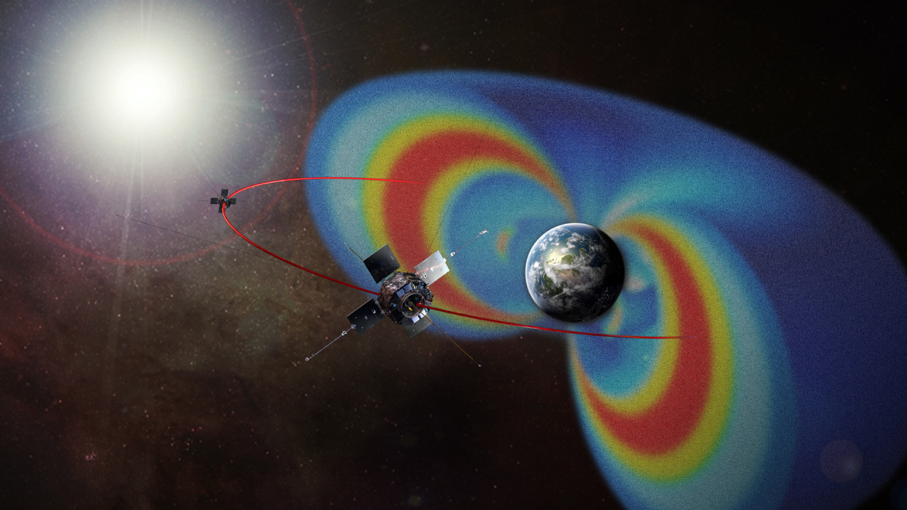
Space Environment Testbeds — or SET, for short — is our mission to study how to better protect satellites from space radiation.
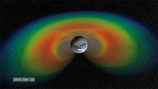
SET aims its sights on a particular neighborhood of near-Earth space called the slot region: the gap between two of Earth’s vast, doughnut-shaped radiation belts, also known as the Van Allen Belts. The slot region is thought to be calmer than the belts, but known to vary during extreme space weather storms driven by the Sun. How much it changes exactly, and how quickly, remains uncertain.
The slot region is an attractive one for satellites — especially commercial navigation and communications satellites that we use every day — because from about 12,000 miles up, it offers not only a relatively friendly radiation environment, but also a wide view of Earth. During intense magnetic storms, however, energetic particles from the outer belt can surge into the slot region.
SET will survey the slot region, providing some of the first day-to-day weather measurements of this particular neighborhood in near-Earth space. The mission also studies the fine details of how radiation damages instruments and tests different methods to protect them, helping engineers build parts better suited for spaceflight. Ultimately, SET will help other missions improve their design, engineering and operations to avoid future problems, keeping our space technology running smoothly as possible.
For more on our space weather research, follow @NASASun on Twitter and NASA Sun Science on Facebook.
Meet the other NASA missions launching on the Department of Defense’s STP-2 mission and get the latest updates at nasa.gov/spacex.
Make sure to follow us on Tumblr for your regular dose of space: http://nasa.tumblr.com.
At
NASA we’re pretty great at putting satellites and science instruments into orbit
around Earth. But it turns out we’re also pretty great at showing people how
to get and use all that data.
One
of the top ways you can learn how to use NASA data is our ARSET program. ARSET
is our Applied Remote
Sensing Training program and it helps people build skills that integrate all
these Earth science data into their decision making.
ARSET will
train you on how to use data from a variety of Earth-observing satellites and instruments
aboard the International Space Station.
Once you take a
training, you’ll be in GREAT company because thousands of people have taken an
ARSET training.
We hold in
person and online trainings to people around the world, showing them how to use
NASA Earth science data. Trainings are offered in air quality, climate,
disaster, health, land, water resources and wildfire management.
For example, if
you’re trying to track how much fresh drinking water there is in your watershed,
you can take an ARSET training and learn how to find satellite data
on how much precipitation has fallen over a certain time period
or even things like the ‘moistness’ of soil and the quality of
the water.
Best yet, all
NASA Earth observing data is open and freely available to the whole world!
That’s likely one of the reasons we’ve had participants from 172 of the
approximately 190 countries on Earth.
Since its
beginning 10 years ago, ARSET has trained more than 30 thousand people all over
the world. They’ve also worked with people from more than 7,500 different
organizations and that includes government agencies, non-profit groups,
advocacy organizations, private industry.
And even though 2019 is ARSET’s 10th birthday
– we’ve only just begun. Every year about 60% of the organizations and agencies
we train are new to the program. We’re
training just about anyone who is anyone doing Earth science on Earth!
Join us, learn
more about how we train people to use Earth observing data here, and heck, you
can even take a training yourself: https://arset.gsfc.nasa.gov/.
Participate in the 50th anniversary of Earth Day by asking our experts anything about NASA’s role in Earth Science!
This year marks the 50th anniversary of Earth Day, and to commemorate the big day we’re bringing you exclusive access our Acting Director of Earth Sciences, Sandra Cauffman, and Associate Administrator for the Science Mission Directorate, Dr. Thomas Zurbuchen! They will be teaming up to take your questions in an Answer Time session on Earth Day, April 22, from 12-1pm EDT here on NASA’s Tumblr! Make sure to ask your question now by visiting http://nasa.tumblr.com/ask!
Our investment in space – both the unique Earth science we conduct from orbit and the technology we’ve developed by living in space and exploring our solar system and universe – is returning benefits every day to people around the world, particularly those who are working on environmental issues. From documenting Earth’s changing climate to creating green technologies to save energy and natural resources, we’re working to help us all live more sustainably on our home planet and adapt to natural and human-caused changes.
From space we study: dust storms, volcanoes, flooding, coral reefs, night lights, wildfires, urban growth, food production, mosquito tracking and other human health issues, precipitation across the world, hurricanes and typhoons, soil moisture, land and sea ice, and changes to the land and sea surfaces.
From airborne research planes we track: changes in polar ice, glaciers, sea level rise, cloud formation, storms, sea level rise and Earth’s changing landscape.
A simulated image of NASA’s Nancy Grace Roman Space Telescope’s future observations toward the center of our galaxy, spanning less than 1 percent of the total area of Roman’s Galactic Bulge Time-Domain Survey. The simulated stars were drawn from the Besançon Galactic Model.
Exploring the Changing Universe with the Roman Space Telescope
The view from your backyard might paint the universe as an unchanging realm, where only twinkling stars and nearby objects, like satellites and meteors, stray from the apparent constancy. But stargazing through NASA’s upcoming Nancy Grace Roman Space Telescope will offer a front row seat to a dazzling display of cosmic fireworks sparkling across the sky.
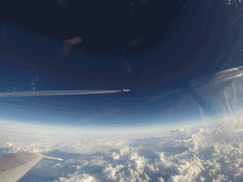
Soaring through the skies! This view looks from the window of our F-18 support aircraft during a 2016 Orbital ATK air-launch of its Pegasus rocket.
The CYGNSS mission, led by the University of Michigan, will use eight micro-satellite observatories to measure wind speeds over Earth’s oceans, increasing the ability of scientists to understand and predict hurricanes.
CYGNSS launched at 8:37 a.m. EST on Thursday, Dec. 15, 2016 from our Kennedy Space Center in Florida. CYGNSS launched aboard an Orbital ATK Pegasus XL rocket, deployed from Orbital’s “Stargazer” L-1011 carrier aircraft.
Pegasus is a winged, three-stage solid propellant rocket that can launch a satellite into low Earth orbit. How does it work? Great question!
After takeoff, the aircraft (which looks like a commercial airplane..but with some special quirks) flies to about 39,000 feet over the ocean and releases the rocket.
Guess what?! We have a new lead for our science missions, and we’re excited to introduce him to you. Recently, NASA Administrator Charles Bolden has named Thomas Zurbuchen as the new head of our organization for science missions. Let’s get to know him…
Zurbuchen was most recently a professor of space science and aerospace engineering at the University of Michigan in Ann Arbor. He was also the university’s founding director of the Center for Entrepreneurship in the College of Engineering.
Zurbuchen’s experience includes research in solar and heliospheric physics, experimental space research, space systems and innovation and entrepreneurship.
We asked him a few questions to see what he has in store for science at NASA…let’s take a look:
1. What is your vision for science at NASA?
Right now, I am focusing on my team and I am learning how I can help them achieve the goals we have; to design and build the missions we are currently working on. Once the presidential transition is complete, we will engage in strategic activity with that team. It has been my experience that the best ideas always come from great and diverse teams working together. I intend to do that here as well.
2. What solar system destination are you most eager for NASA to explore?
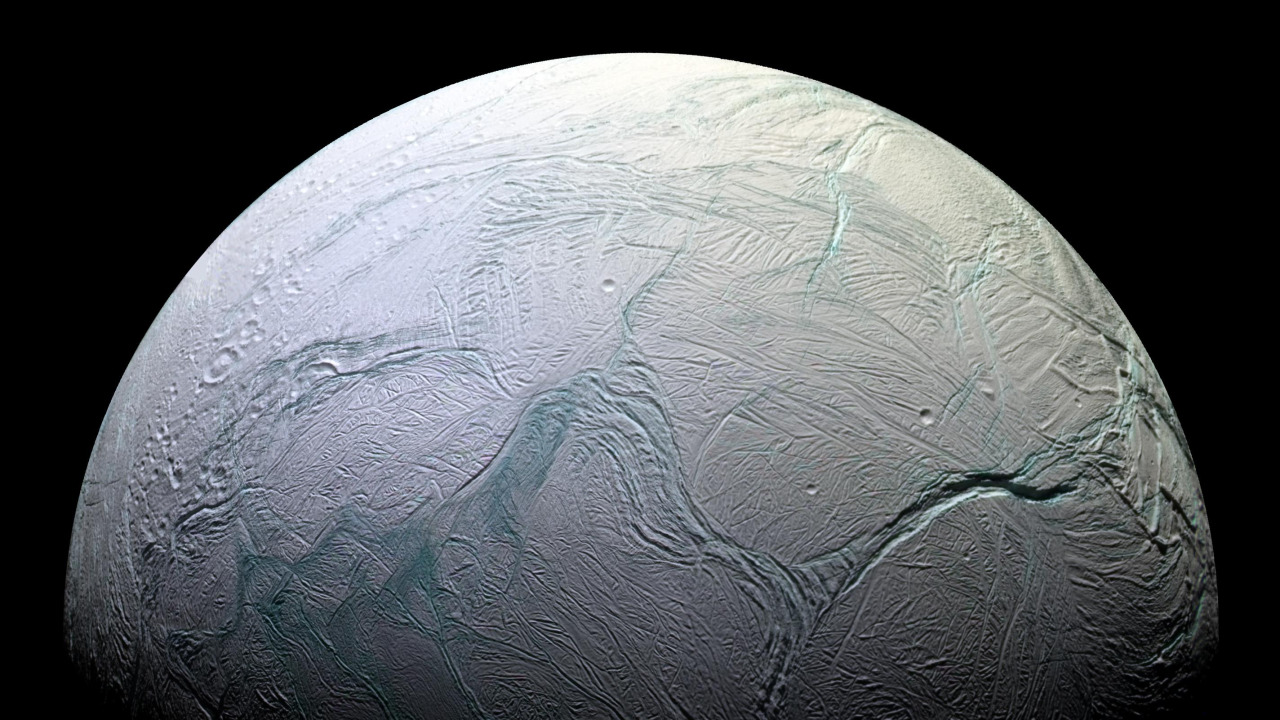
Tough question to answer. Basically, I want to go where there are answers to the most important questions. One question on my mind is the origin of extraterrestrial life. Some parts of the answer to this question can be answered at Mars, some at Europa or other moons in the outer solar system like Enceladus. Other parts of the answer is around other stars, where we have found thousands of planets…some of which are amazingly similar to Earth!
3. With raw images posted to several websites from our missions, what’s one thing you hope members of the public can help NASA do with that powerful data?
I hope that people all over the world play with the data and find new ways to explore. It’s almost like hanging out in the most amazing libraries talking about nature. Many of the books in this library have never been opened and curious minds can find true treasures in there. I know that there are over a billion data-products NASA is making available about the Earth – it’s a treasure chest!
4. In your opinion, what big science breakthrough from the past informs missions of today?
In science, everything we do builds on successes and also failures of the past. Sometimes we forget our failures or near-failures, which tend to teach us a lot about what to do and what not to do. One of my favorite stories is about the Explorer 1 mission: first they observed almost nothing, until they realized that there was so much radiation that the detectors were chocking. The Van Allen Probes is a mission that are conducting the best exploration today of these radiation belts, discovered by Explorer 1. Our exploration history is full of stories like that.
5. Behind every pretty space image is a team of scientists who analyze all the data to make the discovery happen. What do you wish the public knew about the people and work that goes into each of those pretty pictures?
I wish people knew that every picture they see, every data-set they use, is a product of a team. One of the most exhilarating facts of working in space is to be able to work in teams composed of some of the nicest and most interesting people I have ever met. There are some super-famous people I run with every time we are in the same town, others who like to play music and listen to it, and some who have been in space or climbed mountains.
6. If you were a member of the public, what mission events in the next year would you be most excited about?
The public’s lives will be directly affected by our missions in our Earth Science portfolio. Some of them are done together with NOAA, our sister agency responsible for forecasts. For example, GOES will feature a lightning detector that will enable better predictions of storms. We are also launching CYGNSS in December. This NASA mission, composed of 8 spacecraft will provide unique and high-resolution data designed to provide a deeper understanding and better prediction for hurricanes globally.
7. NASA science rewrites textbooks all the time. What do you hope the kids of tomorrow will know as facts that are merely hypothesis today?
I hope they will know about life elsewhere. They will learn how life evolves, and where there is life today.
8. NASA has explored planets within our solar system. With the launch of the James Webb Space Telescope in 2020, what do you hope we learn about distant worlds?
James Webb is going to allow us to go back in time and look at the first stars and first galaxies. This is something we have never seen – we can only guess what will happen. James Webb is going to allow us to look at many, many more planets around other stars and will allow us to start doing the kind of research that links to the question about how habitable life is there.
9. What sort of elements make for an exciting new science discovery? What do you hope is the next big discovery?
Almost always, an exciting discovery is a surprise. Sometimes, discoveries happen because we are looking for something totally different. The biggest discoveries are the ones that change everything we thought before. All of a sudden, nature wags the finger at us and says “you are wrong!” That is how you know you are up to something new.
I hope the next big discovery tells us about the origin of the 95% of the universe we don’t know enough about. We call these 95% “Dark Energy” and “Dark Matter”, but – to be honest – we really don’t know. So, we are today living in a time where we know with 100% certainty that we don’t know what makes up 95% of our universe.
10. In your opinion, why should people care about the science at NASA?
They should care because we improve and protect lives on Earth. They should also care because we make the world we live in bigger. This is because we find things out we never knew, which creates new opportunities for humankind. Some of these opportunities are near-term – they are patents, innovations, companies or great educations. But, some of them are long-term – they change how we think about life itself.
For Earth Day, we’re inviting you to take a moment to celebrate our wonderful water world, Earth. As far as we know, our Blue Marble is the only place in the universe with life, and that life depends on water. Snap a photo of yourself outside and tag it #GlobalSelfie – bonus points if your selfie features your favorite body of water! http://go.nasa.gov/3xFt0H0