The Global Precipitation Measurement mission, or GPM, core satellite provided information on a powerful early spring storm that brought heavy snowfall and heavy rain from the middle of the U.S. to the Southeast.
A strong, upper-level trough of low pressure that dropped down into the Central Rockies in the middle of the week of March 20 produced an early spring storm that dumped heavy snow on the order of a foot or more in a short period of time along the Front Range of Colorado from near Colorado Springs northward through Denver and up into southeastern Wyoming.
Around 2 feet of snow were reported in places like Aurora and Boulder with some of the highest totals reaching 31 inches. Farther to the north, Cheyenne, Wyoming, picked up more than 14 inches of snow from the storm. The blizzard stranded hundreds of motorists along major interstates with winds gusting up to 50 mph; the storm caused Denver International Airport to close for several hours. The heavy wet snow also led to widespread power outages in the region. After hitting Colorado, the storm tracked eastward into the Upper Midwest where it then dumped up to 2 feet of snow across portions of central Wisconsin.
The Integrated Multi-satellite Retrievals for GPM, or IMERG, is used to make estimates of precipitation from a combination of passive microwave sensors, including the GMI microwave sensor onboard the GPM satellite, and geostationary IR (infrared) data.
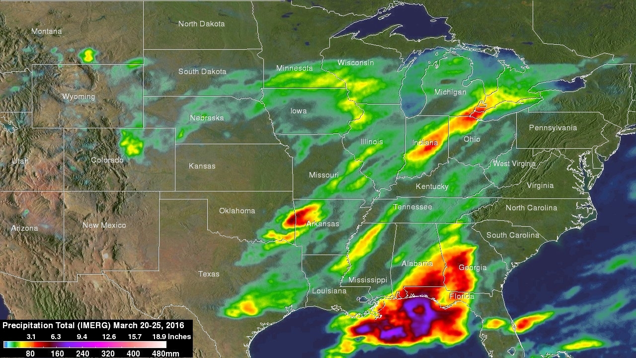
IMERG generated precipitation estimates for the period from March 20 to 25, 2016, for most of the central U.S. from west of the Rockies to the East Coast. IMERG showed liquid equivalent precipitation amounts on the order of 2 inches over northeast central Colorado. Snow ratios can vary greatly, but a good general estimate is roughly 10 inches of snow per inch of liquid, so the IMERG estimate would suggest approximately 20-plus inches of snow in the areas shown in yellow over Colorado.
IMERG showed that the storm dropped lesser amounts over South Dakota, Nebraska and most of Iowa before ramping up again over eastern Iowa, southern Minnesota and central Wisconsin where again on the order of 20-plus inches of snow had fallen.
Locations farther south and east were on the warm side of the storm and received rain. IMERG showed areas of heavy rainfall of at least 2 to 5 inches fell over southeast Texas, southeastern Oklahoma, northwest Arkansas, north-central Mississippi, central Indiana, northwest Ohio, and from the panhandle of Florida across southeast Alabama up into central Georgia. Those higher amounts are mainly associated with thunderstorm activity.
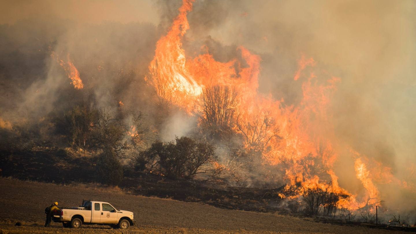
As the main area of low pressure associated with the storm tracked eastward out of the Central Plains and up into the Great Lakes Region, an advancing cold front, which extended all the way down into the Gulf of Mexico drew warm moist, unstable air northward and provided the trigger for those widespread thunderstorms. These storms produced a few isolated tornadoes as well as widespread wind and hail reports.
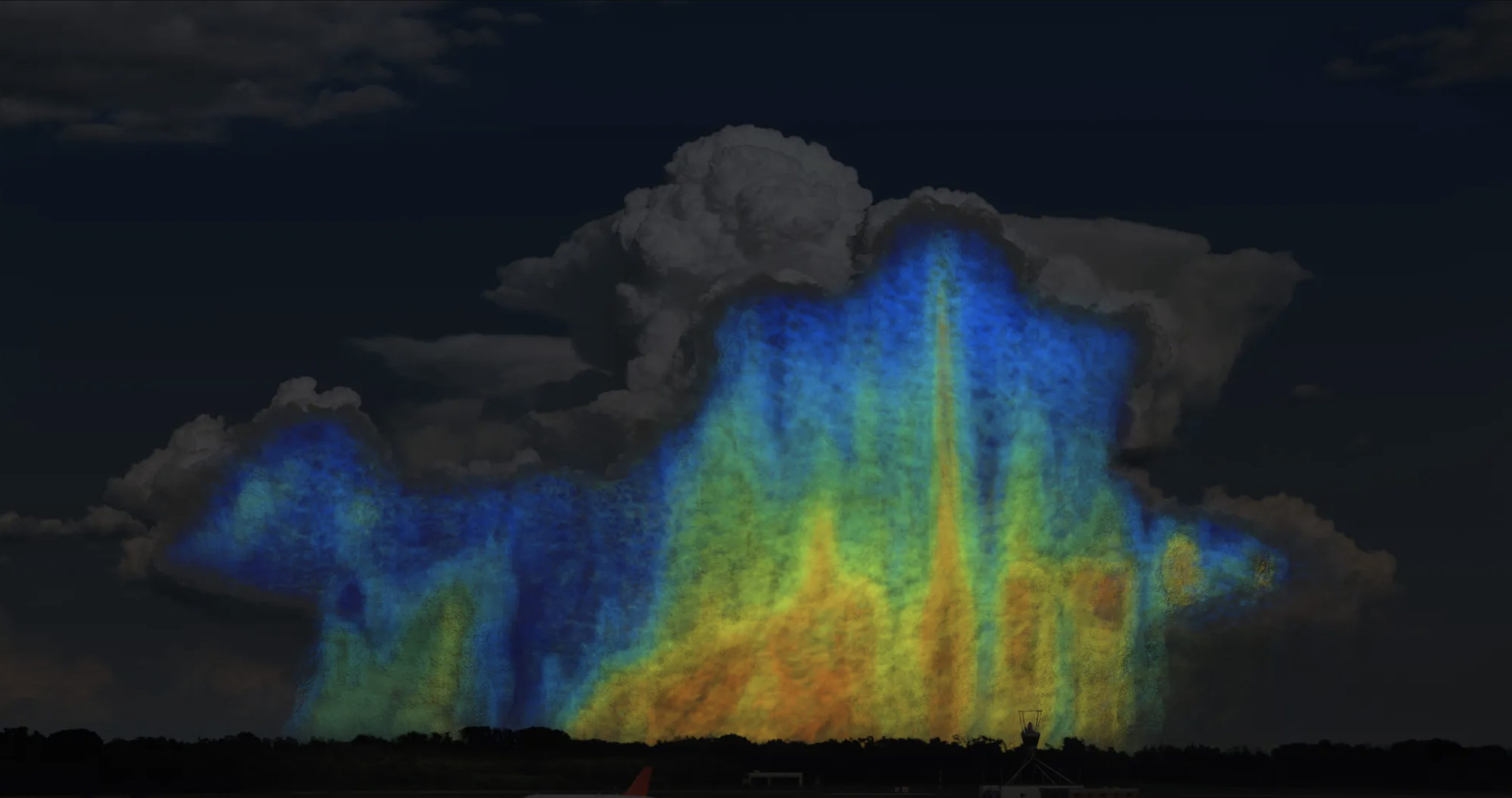
GPM captured an image of the storm on March 23 at 11:56 p.m. EDT (March 24 at 4:56 a.m. UTC) as the surface low was moving across northern Missouri. At the time, the system brought moderate to heavy snow over eastern Iowa and southeastern Wisconsin and a convective band of more intense rain was advancing into western Illinois (bright green arc). The image showing the precipitation rates was created using the GPM GMI instrument and DPR instrument and it was overlaid on infrared data from NOAA’s GOES-East satellite to create a total picture of the storm. The image was created at NASA’s Goddard Space Flight Center in Greenbelt, Maryland.

At NASA, a 3-D image of the March 24 storm that showed highest cloud tops were on the order of 6.2 miles (10 km) high over northwestern Illinois Farther north, where the heaviest snow was falling, cloud tops were fairly low, about 3.1 miles (5 km) high or less.
Large snow events are driven by larger-scale temperature gradients, usually the boundary between opposing air masses, wherein even stable air can be forced to rise over colder air. Thus, snow storms are often quite shallow whereas thunderstorms, which are mainly driven by unstable air (i.e., relatively warm air below colder air), tend to grow vertically and have higher cloud tops.
On March 29, the National Weather Service (NWS) forecast called for another powerful early spring storm. The NWS Weather Prediction Center noted that “A strong storm over the Great Basin will move northeastward to the Middle Mississippi Valley/Central Plains by Wednesday evening (March 30). The system will produce snow and lower elevation rain over parts of the Great Basin and Northern/Central Rockies and expanding into parts of the Northern/Central High Plains on Wednesday.” NWS is calling for heavy rain for parts of the Lower Mississippi Valley/Tennessee Valley and heavy snow possible for parts of the Central/Northern Rockies and High Plains.
GPM is a joint missions between NASA and the Japan Aerospace Exploration Agency (JAXA). For more information about GPM, visit: https://www.nasa.gov/gpm
Steve Lang
NASA’s Goddard Space Flight Center, Greenbelt, Md.