


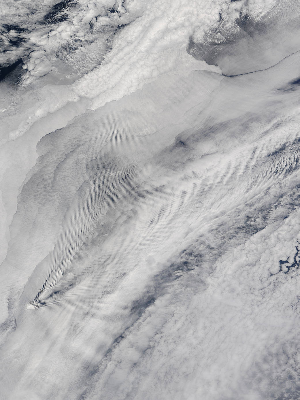
Early November 2015 brought cloudy skies and intriguing patterns over the Prince Edward Islands in the South Indian Ocean. The Moderate Resolution Imaging Spectroradiometer (MODIS) aboard NASA’s Terra satellite captured this scene on November 5.
The Prince Edward Islands have been outlined in black so they can be viewed under the heavy cloud cover. The wind is blowing from the southwest to the northeast. On the windward side of the island the clouds are undisturbed. On the leeward side, however, the turbulent air has formed a pattern known as ship-wave-shaped clouds. The pattern gets its name because the cloud pattern resembles the waves created by moving objects, like a ship or even a duck. In this case, the object (Prince Edwards Islands) were stationary, and it was the wind moving past. While the mechanisms are different, the waves generated in each fashion have similar forms.
In this case, the moving air swept around the tall peaks of the mountains on the Prince Edward Islands and created turbulent air on the leeward side. The flow of the turbulence is in a spreading V shape behind the point. At the same time, the forward motion occurs in waves, with peaks and trough as the turbulent air flows further away from the point source which caused it. When atmospheric conditions are right, cloud form on the cool peaks of a wave of air but cannot form on the low trough. The result, as seen in this image, are areas of clear and cloud-filled stripes perpendicular to the forward motion of the turbulence.
Image Credit: NASA/Jeff Schmaltz, MODIS Land Rapid Response Team, NASA GSFC